Chart your course
Latitude and Longitude for Sailors
Quick answer
The short version
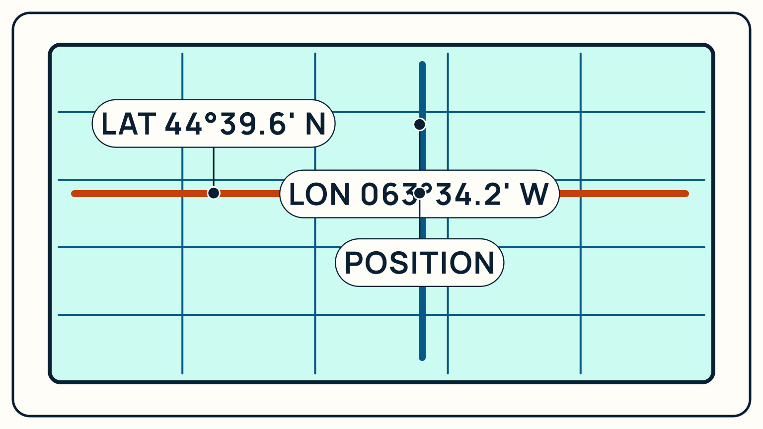
Latitude and longitude locate any point on earth using two angles: latitude measures how far north or south of the Equator you are, from 0 to 90 degrees, and longitude measures how far east or west of the prime meridian, from 0 to 180 degrees. A GPS commonly shows both as degrees and decimal minutes, for example 44° 39.6' N, 063° 34.2' W, meaning 44 degrees and 39.6 minutes of latitude north of the Equator, and 63 degrees and 34.2 minutes of longitude west of the prime meridian. Read latitude first, then longitude, always with a direction letter attached, and you can find or describe any position on any chart in the world.
Every other position-finding skill on a boat, a fix from bearings, a dead-reckoning estimate, a waypoint typed into a GPS, ultimately gets expressed in latitude and longitude. It is worth understanding the grid itself rather than only typing numbers into a chartplotter, because the format and the scale both hide details that matter the moment you are working from a paper chart or checking a position by hand.
Two angles, measured from two fixed lines
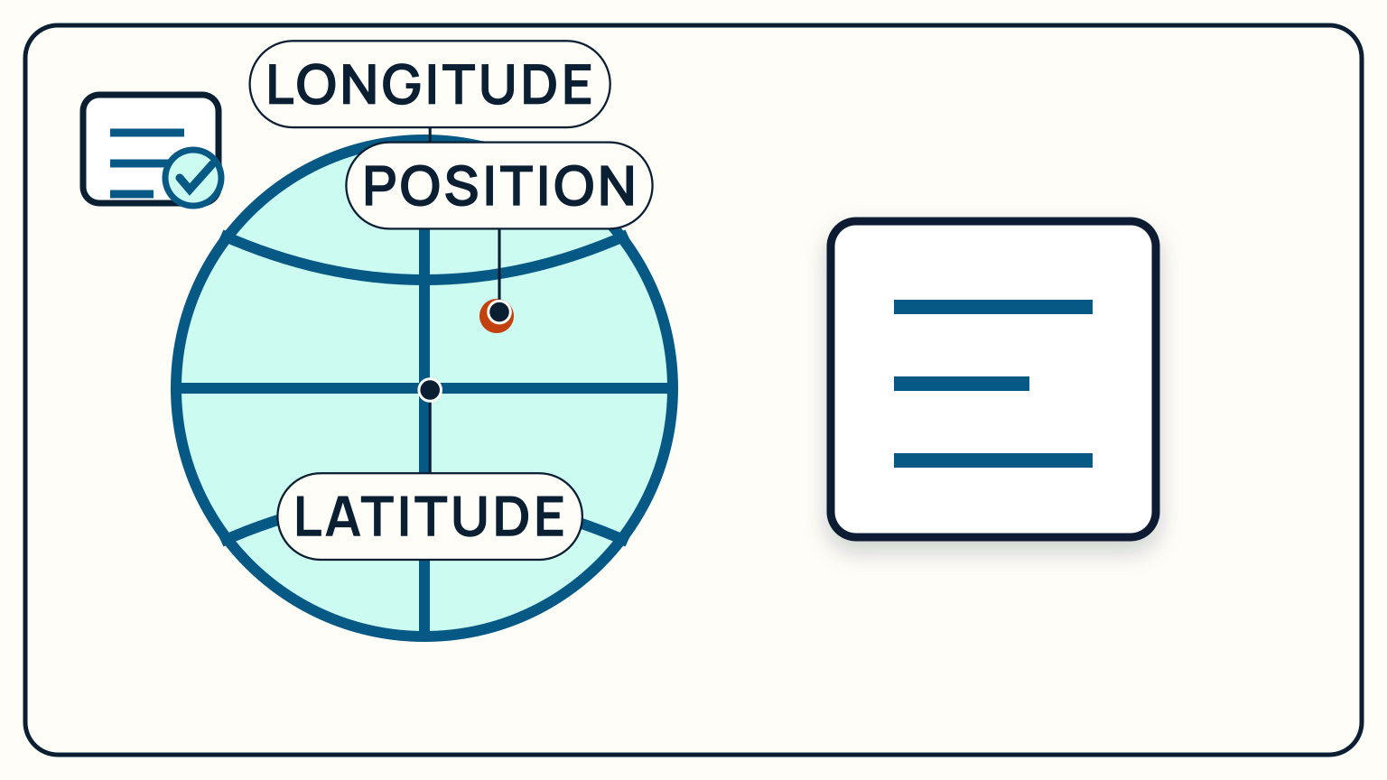
Latitude lines, called parallels, circle the globe running east to west, always parallel to each other and to the Equator, which is fixed at 0 degrees. Latitude increases toward each pole, reaching 90 degrees north at the North Pole and 90 degrees south at the South Pole. Because parallels never converge, they stay evenly spaced from the Equator all the way to either pole.
Longitude lines, called meridians, run the other way: north to south, pole to pole, each one a half-circle from the North Pole to the South Pole. Longitude is measured from the prime meridian, fixed at 0 degrees by international agreement at the 1884 International Meridian Conference as the line running through Greenwich, England, and it runs up to 180 degrees east and 180 degrees west of that line. Unlike parallels, meridians converge: they sit farthest apart at the Equator and meet exactly at both poles.
That single geometric difference, parallels evenly spaced and meridians converging, is the reason latitude and longitude behave differently the moment you try to measure distance with either one, covered further down.
Reading the degrees-and-minutes format
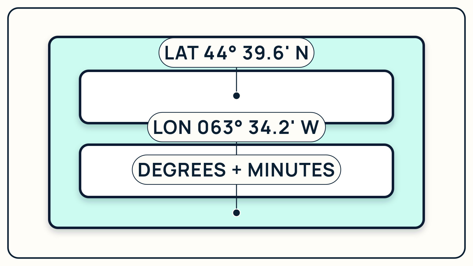
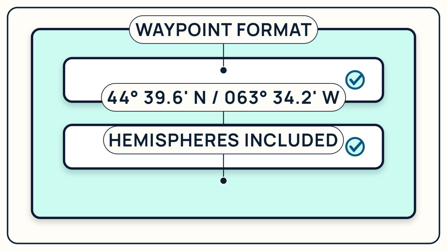
Each degree of latitude or longitude splits into 60 minutes, and most marine GPS units display position as whole degrees plus decimal minutes rather than minutes and seconds, written like 44° 39.6' N, 063° 34.2' W. Read that as 44 degrees and 39.6 minutes of latitude, north of the Equator, and 63 degrees and 34.2 minutes of longitude, west of the prime meridian.
Latitude always comes first, longitude second, and the direction letter is not optional. Drop the N and that same latitude value describes a point in the Southern Hemisphere instead; drop the W and the longitude flips to the far side of the prime meridian. A position missing its direction letters is not a smaller error than a wrong number. It is a completely different point on the globe, possibly thousands of miles away.
If you ever need to convert decimal minutes to seconds, or the other way around, the relationship is the same as any other base-60 unit: multiply the decimal portion of a minute by 60 to get seconds, or divide seconds by 60 to fold them back into a decimal minute. Most sailors never make that conversion by hand, but it helps to understand what the decimal point actually represents.
Plot two lines and find where they cross
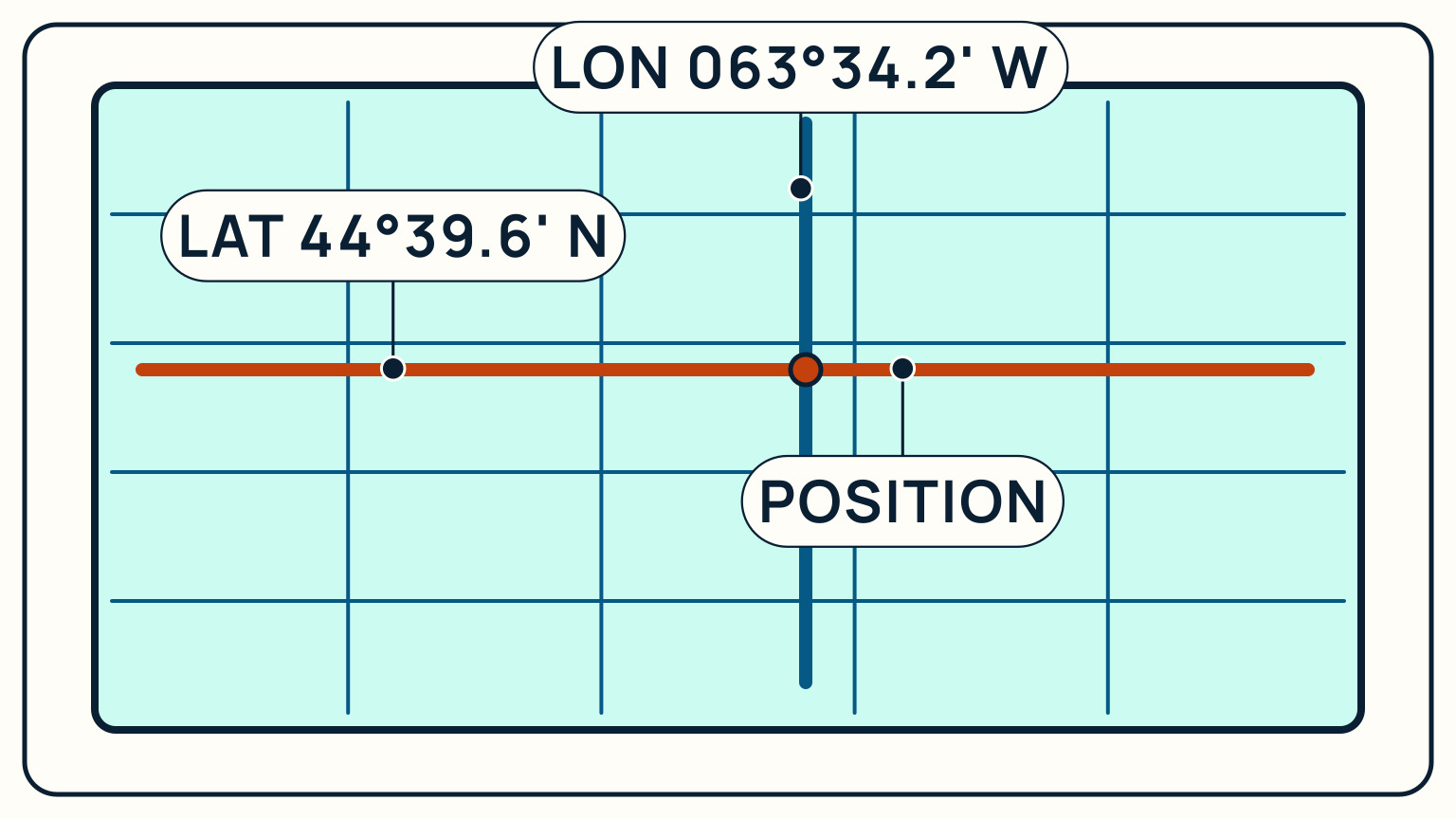
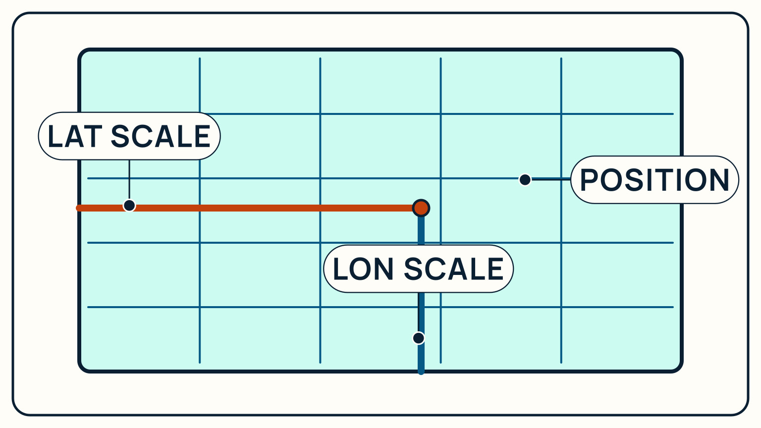
To plot a position on a paper chart, find the latitude value on the scale running up the chart's side, mark it, and draw a line straight across, parallel to the top and bottom edges. Then find the longitude value on the scale running along the top or bottom, mark it, and draw a line straight down, parallel to the sides. Where the two lines cross is the position.
The chart's own grid lines, printed lightly across the whole sheet, help you judge the two marks even without a ruler, since both scales are subdivided into small, labeled steps. Parallel rulers or a plotting tool make the two lines faster and more precise to draw, but the underlying idea does not change: latitude fixes how far up or down the position sits, longitude fixes how far across, and together the two numbers pin down one exact point.
This is the same crossing idea behind a compass-bearing fix, just built from two coordinate values instead of two sighted objects. Either way, one number alone only narrows things down to a line; it takes two to find a point.
Measure distance on the latitude scale, never the longitude scale
Because parallels are evenly spaced everywhere, one minute of latitude is always one nautical mile, on any chart, at any latitude. That single fact is why the scale running up the side of a nautical chart doubles as a distance scale: walk a set of dividers along it, and the number of minutes you span is the number of nautical miles.
Longitude cannot make the same promise, because meridians converge toward the poles. One minute of longitude equals one nautical mile only right at the Equator; move toward either pole and that same one minute of longitude covers less and less actual distance, since the meridians sit physically closer together there. Measuring distance on the longitude scale anywhere other than the Equator quietly gives you the wrong number, even though the scale looks just as precise as the latitude one.
The rule that avoids the mistake entirely: always measure distance on the latitude scale nearest your own position on the chart, never on the longitude scale along the top or bottom, and on a large chart use the latitude scale closest to the area you are actually measuring, since even that scale stretches slightly from the Equator toward the poles.
Check the datum before you trust the numbers
A latitude and longitude value is only meaningful relative to a reference frame, called a datum, and a mismatched datum can move the same coordinate by a genuinely dangerous distance on the chart. Most GPS receivers default to WGS 84, the global reference system built around the earth's actual center, and most current charts are compiled on it too, so in practice the two usually agree.
They do not always agree. Some older or regional charts still reference a different local datum, and the U.S. National Geospatial-Intelligence Agency has documented shifts of more than 700 meters between the Tokyo datum used on some older Japanese and Korean charts and WGS 84, and shifts of half a nautical mile or more on some isolated Pacific island charts referenced to their own local datum. A GPS position plotted straight onto a chart using a different datum, without adjustment, can sit hundreds of meters from where the chart actually shows it.
Check the datum note printed on the chart itself before you trust a plotted position near any hazard, and make sure your GPS receiver's datum setting matches it, or applies the correction the chart specifies. When both are known and matched, the numbers you read off a GPS and the numbers you plot on the chart describe the exact same point.
Worth remembering alongside the datum check: a GPS position is often more precise than the survey data an older chart was built from in the first place. NGA's own guidance to navigators puts it plainly, that mariners should continue giving charted hazards a wide berth no matter how confident the GPS number looks, since the chart itself may be the less accurate half of the comparison. A precise latitude and longitude is not the same thing as a precisely charted one.
One more format worth recognizing: some chartplotters, phone apps, and mapping software display decimal degrees instead of degrees and minutes, writing the same position as plain numbers like 44.6600, -63.5700, with a negative sign standing in for south or west instead of a letter. It is the identical coordinate, just formatted differently, so check which format a device is set to before copying a position between a chart, a logbook, and an app by hand.
Latitude and longitude look like a simple pair of numbers, but reading them correctly, measuring distance with them, and matching them to the right datum are three separate skills quietly doing the work behind every GPS display. Cross-check a plotted position with a compass bearing or a running dead-reckoning estimate whenever you can, even when the electronics look confident. SailStarter's Module 10 course covers the whole chain from reading a chart to plotting a position on it, taught visually with a quiz after each lesson.
Try it from the lesson
Can you spot the next move?
You take a single bearing on a lighthouse. What does that one bearing actually tell you (your exact position, or something less)?
Why you can trust this guide
. We build each guide from public seamanship and safety sources, then teach the universal principle before any local difference.