Chart your course
Where Am I? How to Take a Position Fix
Quick answer
The short version
To take a position fix, cross two or more position lines (bearings taken on charted objects) so they meet at, or close to, a single point. Take three bearings when you can, spread roughly 90 to 120 degrees apart: two crossing lines can look right even when one of them is wrong, but a third usually reveals the error as a small triangle called a cocked hat. Favor land features over buoys, which can drift off their charted position. A transit, two objects seen exactly in line, gives you the strongest position line there is, with no compass needed at all. Between fixes, carry your position forward with dead reckoning: last known position, course, speed, and time. Log every fix (the time and the position) so you, or anyone else aboard, can pick up exactly where you left off.
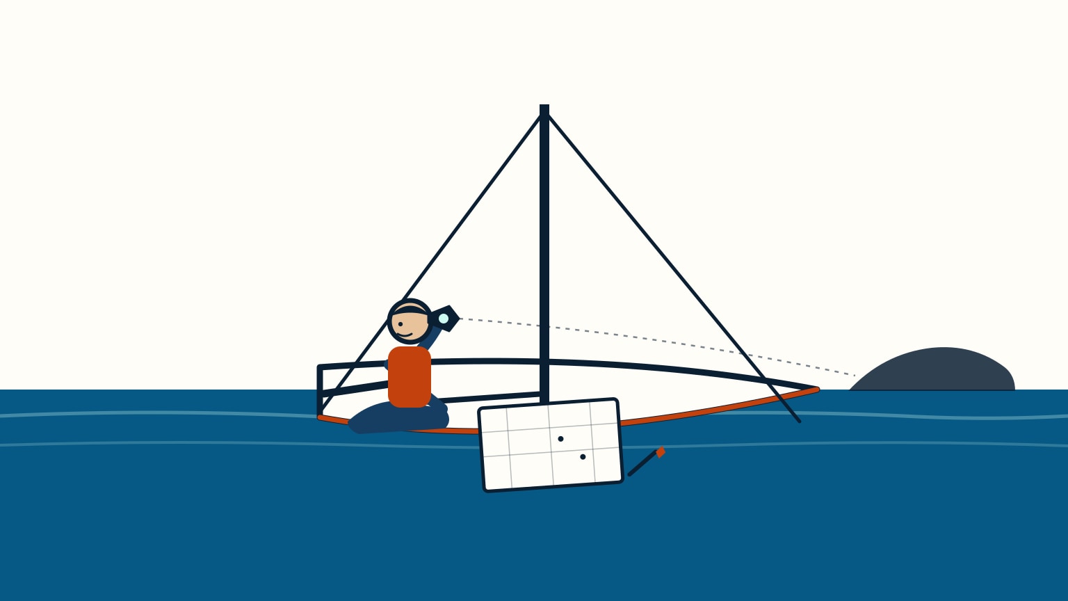
Your phone or chartplotter can already tell you roughly where you are, often within a few yards, in the time it takes to glance at the screen. That's a genuinely good starting point, not the end of the thinking. GPS units lose satellite lock, drift briefly, or occasionally just get it wrong, and none of that shows up as an error message on the display. The habit worth building, long before you ever need it for real, is knowing roughly where you are at all times and being able to say so: to your own logbook, to a crewmate taking the helm, or to a coastguard on the radio if it ever comes to that. A position only earns its keep once you can pass it on. This is how sailors have always fixed a position, satellite or no satellite: cross bearings on charted objects, read the shape they make, and carry that position forward until the next one.
Start With GPS, Then Check It
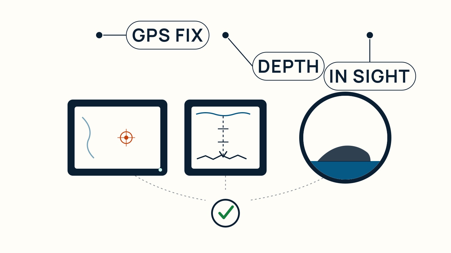
GPS earns its trust the same way anything else on the water does: you check it against something else. Two checks are always close at hand. First, your depth sounder: compare the depth it shows, corrected for the state of the tide, against the charted depth at the position your GPS claims. Agreement is reassuring; a mismatch is a reason to slow down and look again. Second, your own eyes: does what you can actually see, a headland, a light, a buoy, sit where the chart says it should relative to where the GPS puts you? The depth check works even with no land in sight, and it doubles as a position line of its own: with only one or two charted objects visible, you can cross a single bearing with a depth reading and narrow yourself down to a stretch of that line, rather than guessing at a point. None of this makes GPS unreliable. It makes GPS one good input among several, which is exactly how a fix is supposed to work.
One Bearing Is a Line, Three Make a Fix
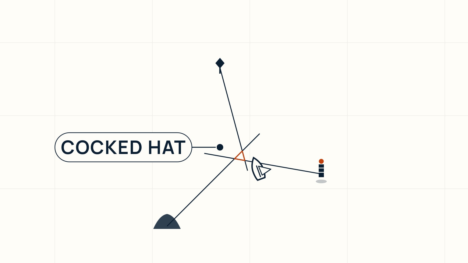
A single bearing on a charted object doesn't give you a point. It gives you a position line, the line somewhere along which you must be standing, without yet telling you where on it. Cross that line with a bearing on a second object and the two meet at one point: a fix. Two lines are useful, but a single mistaken bearing can still cross a good one cleanly and look correct. Take a third bearing whenever you can, spread roughly 90 to 120 degrees around from the others, and an error usually shows itself: the three lines rarely all meet at one point, instead forming a small triangle called a cocked hat. A small cocked hat is normal. Most sailors simply take the corner nearest any nearby danger as their position, to be safe. A large one is different: retake the bearings, ideally sighting different objects than you used the first time. Choose objects that are charted and easy to identify, favoring land features (a lighthouse, a headland, a church spire, the kind of detail a chart marks precisely) over buoys, which can be dragged off their charted position by wind or current. Take each bearing with a hand-bearing compass held well clear of anything magnetic, or by sighting over the boat's own steering compass, which adds a correction for that compass's own onboard error (deviation) on top of the usual correction for magnetic variation.
Transits Need No Compass at All
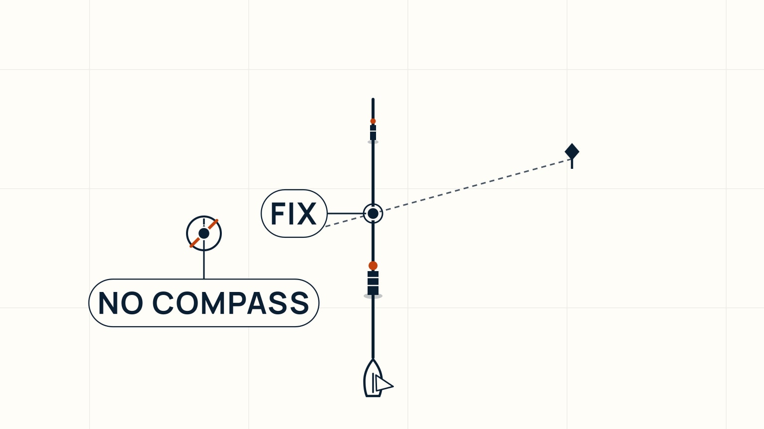
Two charted objects seen exactly in line, a lighthouse behind a headland, a church spire behind a breakwater end, give you a position line stronger than any compass bearing, because there's no compass, no variation correction, and no deviation correction to get wrong. You're either on the line the two objects form, or you're not. There's no reading to argue with. Harbors build this into permanent leading marks on purpose: two lights set up so the nearer one shows lower than the farther one, so keeping them stacked exactly one above the other holds you on the safe track through a channel. You don't need official marks to use the idea: any two identifiable, charted features that line up work the same way, and crossing that transit with a single compass bearing on a third object turns it into a full fix without needing a second bearing at all. If you're steering a compass course toward one of the objects rather than along the transit itself, the same steering-compass habits that keep a heading steady help you hold it here too.
Carry It Forward, Then Write It Down
Make every fix answer a question
Choose the question before taking bearings: Are we clear of a shoal? Have we reached a turning point? Is the current setting us off track? Which side of a channel are we on? Select charted objects whose bearings cross at useful angles and can be identified without doubt. Three well-spread lines usually expose disagreement better than two nearly parallel ones.
Take bearings in quick succession and note the exact time. A moving boat changes position between observations, so speed matters. When delay is unavoidable, advance the earlier line by the boat's estimated course and distance to the time of the later observation. Record that construction separately from a simultaneous fix.
Plot lines lightly and label them with object, bearing, and time. A small triangle rather than one perfect intersection is normal evidence of measurement differences. Do not choose the most convenient corner. Assess the whole result against hazards and use the conservative side when safety depends on it.
Cross-check electronic position
Plot a visual fix periodically even when GPS is primary. Compare it with the electronic position, charted depth, expected shoreline, and aids to navigation. Agreement increases confidence in the complete picture. Disagreement is a reason to slow down and check object identity, compass correction, plotting, chart datum, device settings, and depth.
A transit can provide a strong line without a compass when two charted objects align. Note the moment of alignment and draw the line through them. Combine it with another bearing, depth contour, or position source appropriate to the situation.
The nautical chart guide covers symbols, scale, and depth, while chartplotter versus tablet navigation explains why a second screen is not automatically an independent source. A fix is most useful when it changes or confirms a decision, then enters the log with the action taken.
A fix only tells you where you were the moment you took those bearings. By the time you've plotted it, the boat has already moved on. Dead reckoning is how you carry that position forward: take your last confirmed fix and project ahead using your course, your speed, and how much time has passed since. It's an estimate, not a fix, and it gets less certain the longer you run on it, which is exactly why you take a fresh fix as soon as you reasonably can rather than trusting dead reckoning indefinitely. None of this works, though, if the fix itself isn't written down. Mark it on the chart with the time and your log's distance-run reading the moment you take the bearings, not afterward from memory: that record is what lets you, or anyone else who steps up to the chart, pick up exactly where you left off, work forward by dead reckoning, and answer the only question that ever really matters out there: roughly where are we right now, and can we say so?
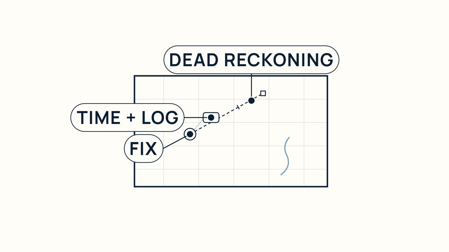
None of this needs to be complicated to be worth doing well. Cross two bearings, take a third when you can, and get comfortable reading a small cocked hat rather than chasing an impossible single point. Look for a transit whenever the geography hands you one: it's the easiest position line you'll ever plot. Carry your position forward with dead reckoning between fixes, and write each one down the moment you take it. Do that consistently and GPS becomes what it should always have been: one good input, not the only one you trust. SailStarter's lessons work through this same chartwork step by step once you know where you're headed. If taking a fix still feels like guesswork, that's exactly the gap the lessons are built to close.
Try it from the lesson
Can you spot the next move?
You take a single bearing on a lighthouse. What does that one bearing actually tell you (your exact position, or something less)?
Why you can trust this guide
. We build each guide from public seamanship and safety sources, then teach the universal principle before any local difference.