Chart your course
Distance, Speed, and Time for Sailors
Quick answer
The short version
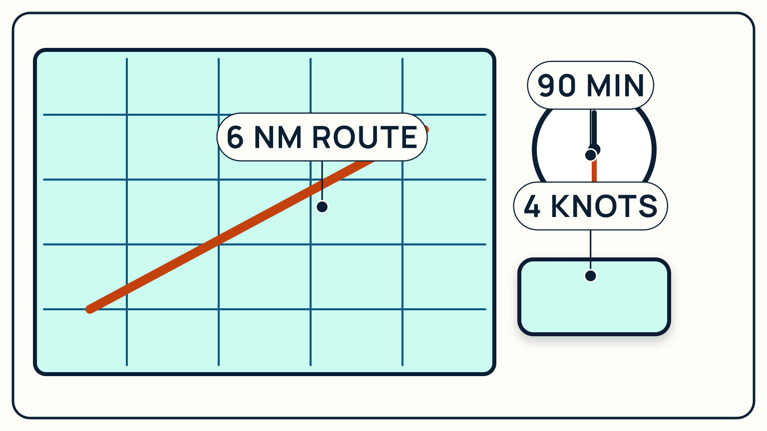
Nautical distance, speed, and time follow one relationship: distance in nautical miles equals speed in knots multiplied by time in hours, or D = S × T. Flip it around to solve for whichever piece you are missing, time equals distance divided by speed, and speed equals distance divided by time. A boat holding 4 knots covers 6 nautical miles in an hour and a half. That number is a planning estimate, not a promise. Wind, current, sail changes, and simple delays all change how fast you actually move over the ground, so treat the arithmetic as a starting point and keep checking your actual progress against it once you are underway.
This is worth knowing cold, because so much of coastal sailing decision-making runs through it: how long a passage will take, when to leave to catch a tide gate, whether you will reach a harbor before dark, how far you have actually gone since your last position check. None of that needs a calculator built into the boat. A pencil, a watch, and the formula above cover most of what a day sail or a short coastal hop asks of you, and the same relationship scales up to a multi-day passage with a few more waypoints along the way.
The formula behind every rough ETA
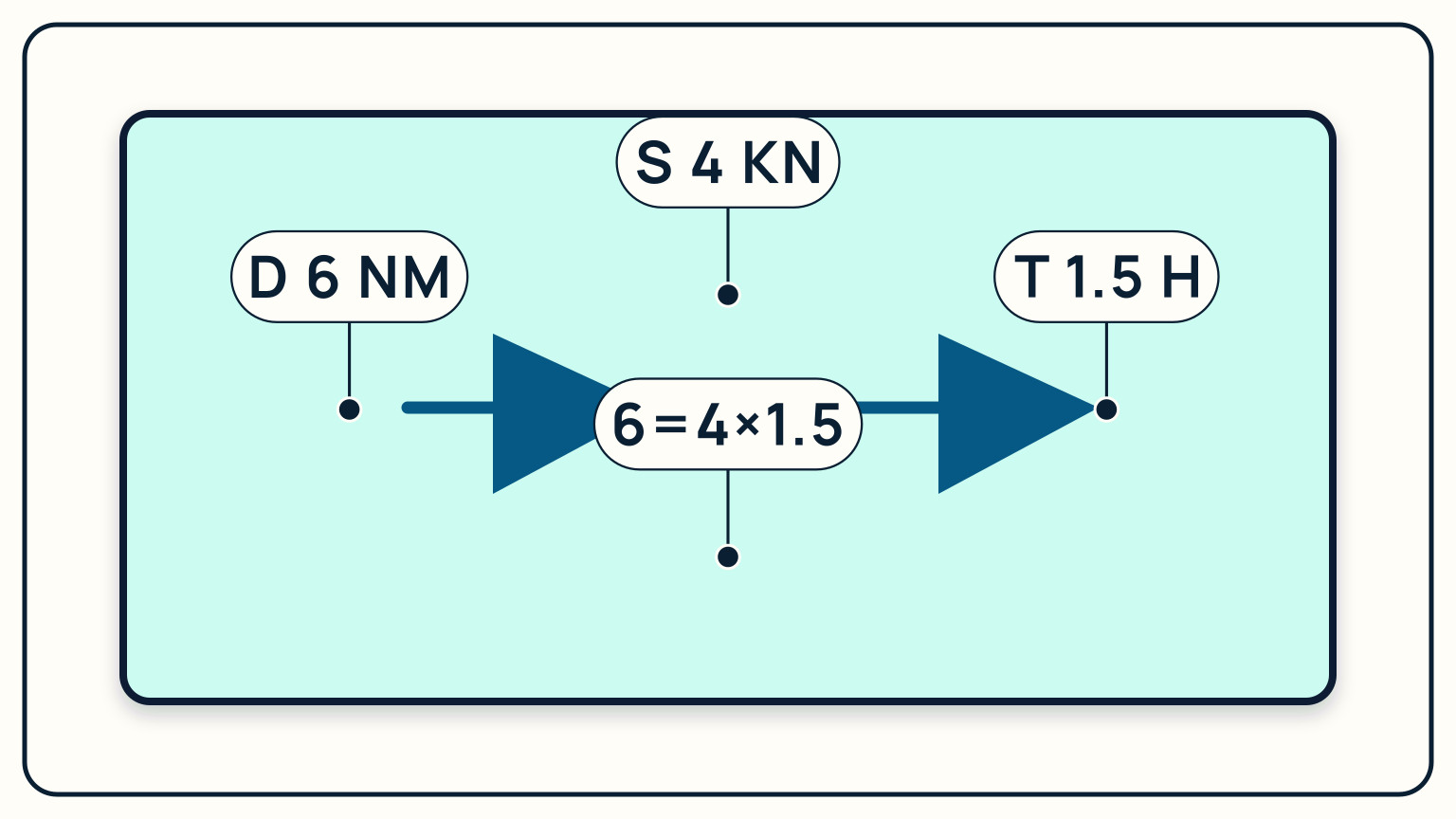
Speed at sea is measured in knots, and a knot is one nautical mile covered in one hour. The nautical mile itself is a fixed, worldwide unit, exactly 1,852 meters, about 1.15 times a statute mile on land. Multiply the two together with time and you get the whole relationship sailors lean on for rough planning: distance equals speed multiplied by time, D = S × T.
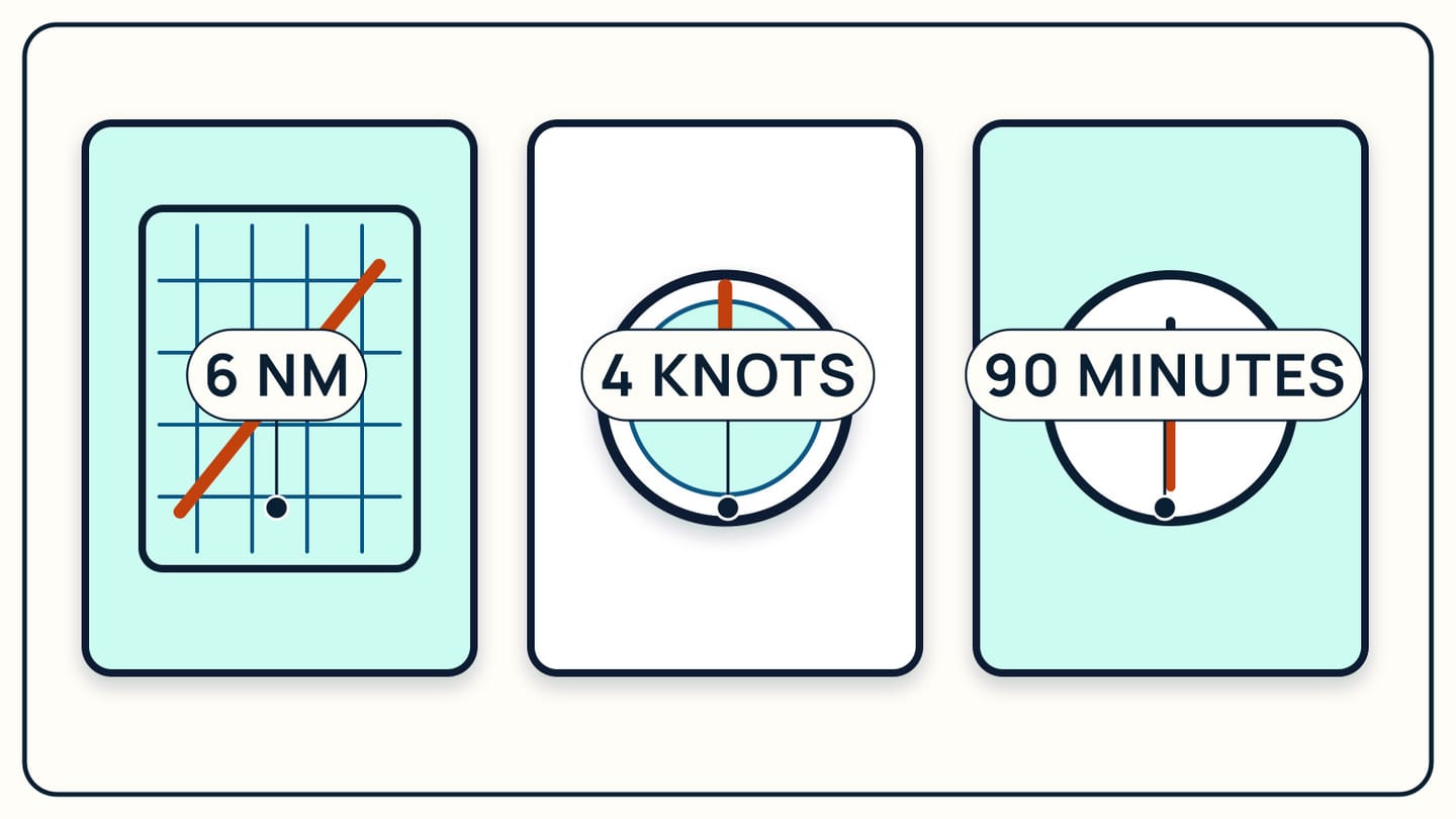
Say your boat is making a steady 4 knots and you want to know how far you will travel in an hour and a half. Multiply: 4 knots times 1.5 hours equals 6 nautical miles. That is the whole calculation, and it works in reverse just as easily. If you know the 6-nautical-mile distance to your next mark and you are making 4 knots, divide distance by speed to get time: 6 divided by 4 equals 1.5 hours, an hour and thirty minutes. If you know you have exactly 90 minutes of daylight left and need to cover 6 nautical miles, divide distance by time to get the speed you need to hold: 6 divided by 1.5 equals 4 knots.
Three numbers, one relationship, and whichever two you know, you can find the third. That is the entire trick, and it is worth doing on paper a few times until reaching for it feels automatic rather than like a small math problem.
Keep the units honest
The formula only works cleanly when every quantity is in the units it expects: nautical miles for distance, knots for speed, and hours for time. Mix in statute miles, or leave time in minutes without converting, and the arithmetic quietly breaks even though you followed the right steps.
Time is the unit that trips people up most, because a watch reads minutes and the formula wants hours. Ninety minutes is 1.5 hours, not "1 hour 30," so convert first by dividing the minutes by 60. Forty-five minutes becomes 0.75 hours; twenty minutes becomes about 0.33 hours. There is a shortcut that skips the conversion entirely: since 60 minutes make an hour, you can multiply speed by minutes and divide by 60 in one step, written as 60 times D equals S times T when T is in minutes. A boat making 4 knots for 90 minutes covers 4 times 90, divided by 60, which is 6 nautical miles, the same answer as before, without ever writing down "1.5 hours."
That same shortcut gives you a fast mental check over short intervals. In exactly 6 minutes, a vessel covers its speed in knots divided by 10, because 6 minutes is one-tenth of an hour. At 4 knots that is 0.4 nautical miles every 6 minutes, a number worth knowing when you are watching a mark or another vessel close a short distance quickly.
Speed through the water is not speed over the ground
The knots your boat's log or GPS shows are usually speed through the water: how fast the hull is moving relative to the water around it, which is what your sails and engine are actually producing. Speed over the ground is different, and it is the number that decides your true arrival time, because it includes whatever the current is doing to you underneath.
A current running with you adds to your progress; a current running against you eats into it. NOAA's own description of ocean currents frames the effect plainly: moving water carries a vessel along on top of whatever course and speed the vessel is being steered and driven at. A boat making a genuine 4 knots through the water, set forward by a 1-knot current running the same direction, is actually covering the ground at 5 knots. The same boat pushing against that current nets only 3.
For the 4-knot, 6-nautical-mile passage from the formula above, that difference is the gap between arriving in about an hour and twelve minutes and arriving in a full two hours. Neither number is wrong; they answer different questions. Plan your rough time using the speed you expect to hold through the water, then treat current, wind strength, and points of sail as the reasons your actual arrival lands a little earlier or later than the pencil answer.
Break a passage into legs you can check
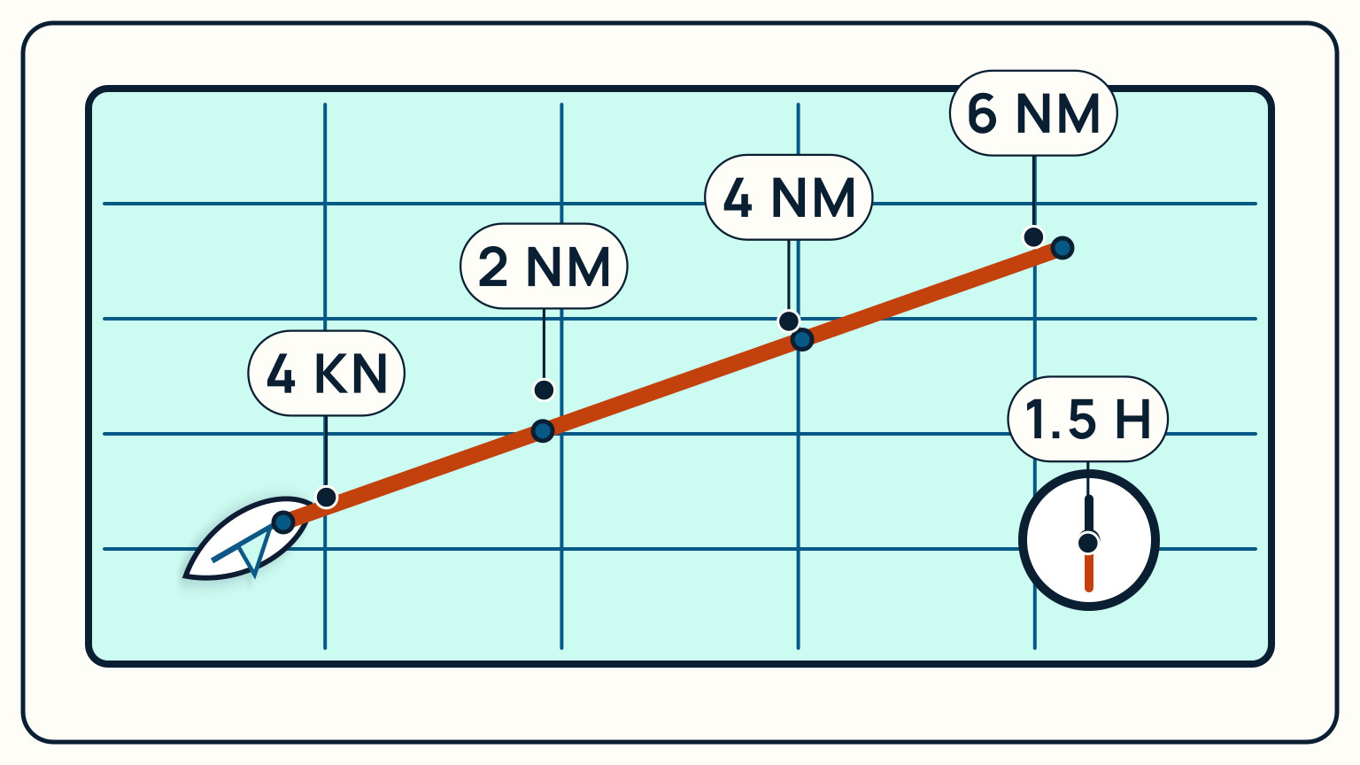
A single distance-speed-time calculation for an entire passage hides a lot of useful information. Split the same trip into shorter legs instead, and you get checkpoints you can actually use once you are underway rather than a single total that either turns out right or does not.
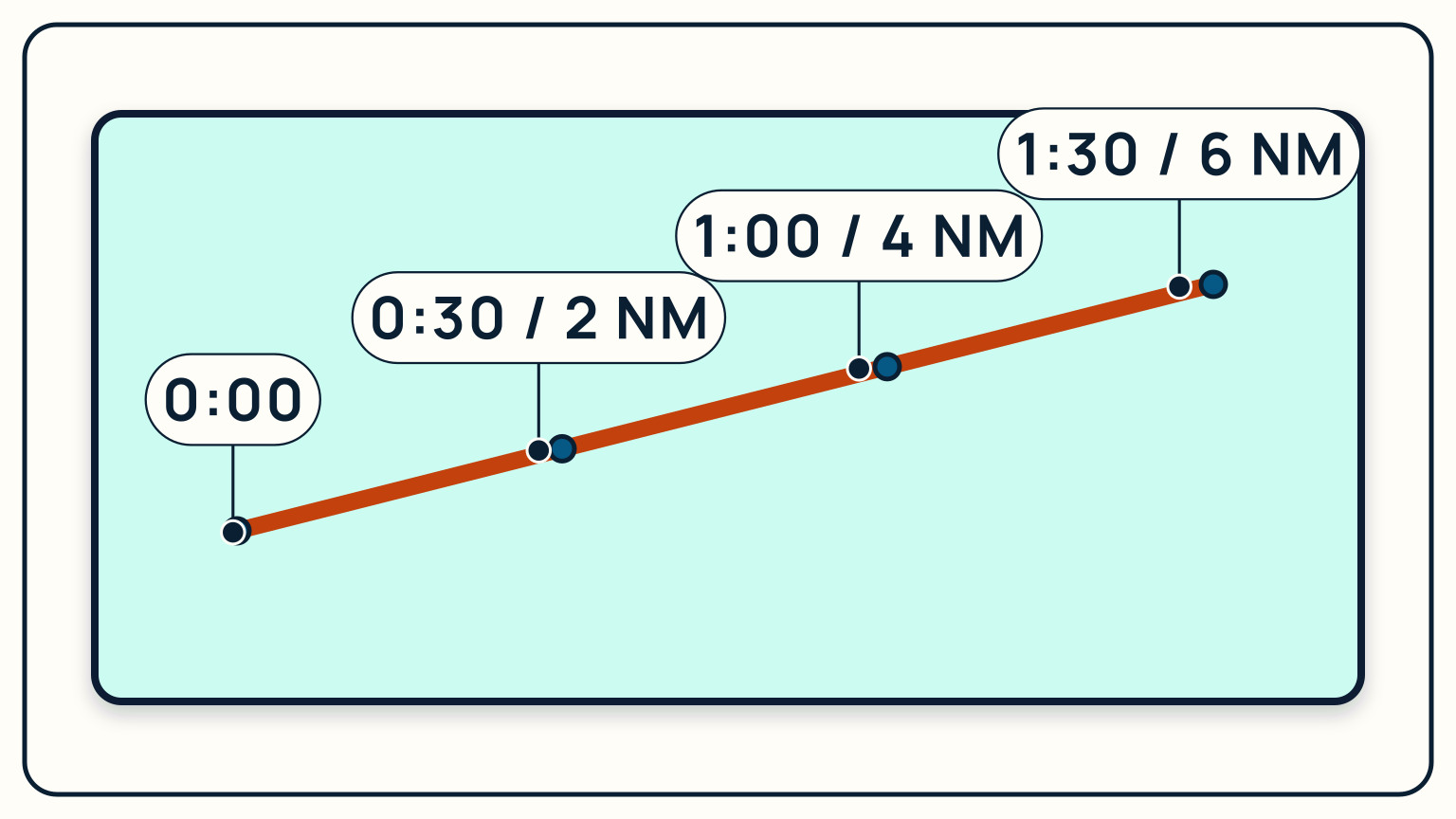
Take that 6-nautical-mile route again and divide it into three legs of 2 nautical miles each. At a steady 4 knots, each 2-nautical-mile leg takes 2 divided by 4, which is 0.5 hours, or 30 minutes. Mark those legs on the chart or in your log: 30 minutes in, you expect to have covered 2 nautical miles; at 60 minutes, 4 nautical miles; at 90 minutes, the full 6. Each mark is a small test of the plan against reality.
If you check your position at the 30-minute mark and you have only covered 1.5 nautical miles instead of 2, you know immediately that something is off, whether it is current, a slower boat speed than planned, or a course that is not quite what you intended, rather than discovering it as a late arrival at the very end. Shorter legs turn one long guess into several small, checkable ones, and checkable is what makes a plan useful on the water instead of just on paper. That habit of legging out a passage is also where dead reckoning begins, advancing a known position using exactly this course-speed-time arithmetic.
Build a margin into the plan before you leave
A rough plan built purely from the formula assumes the wind holds, the current behaves as expected, and nothing goes wrong. None of those assumptions survive a full day on the water intact, so the last step is padding the plan rather than trusting the bare arithmetic.
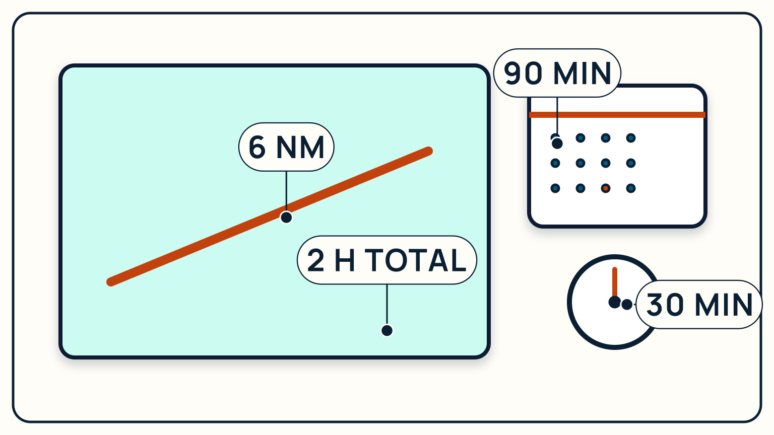
For the 6-nautical-mile, 90-minute passage used throughout this guide, a sensible plan does not book exactly 90 minutes of daylight or exactly enough fuel and time for that number alone. Add a margin, in this case 30 minutes, so the actual budget is 90 minutes of expected sailing time plus 30 minutes of slack for a header, a lighter patch of wind, or a slower-than-planned start. That gives a working total of two hours from departure to a safe arrival, even though the pencil answer alone said an hour and a half.
How much margin is enough depends on the passage: a short daylight hop between two points you know well needs less padding than a longer trip toward a schedule with real consequences for missing it, like a lock, a bridge opening, or the last of the daylight. Whatever the number, write it down before you leave, alongside your planned course and speed, so the margin is a decision you made ashore rather than a fact you discover afloat.
Distance, speed, and time are the arithmetic underneath almost every other navigation skill: dead reckoning, arrival estimates, tide gates, and deciding whether to reef before the wind builds all lean on this same relationship. None of it needs special equipment, just a pencil, a watch, and the habit of checking your plan against what actually happens once you are moving. SailStarter's Module 10 lessons pick this up directly, working through reading a chart and fixing your position as the next pieces of the same navigation picture.
Try it from the lesson
Can you spot the next move?
On a NOAA paper chart, you see buff, green, and blue close to shore. What does each colour mean?
Why you can trust this guide
. We build each guide from public seamanship and safety sources, then teach the universal principle before any local difference.