Chart your course
AIS for Recreational Sailors
Quick answer
The short version
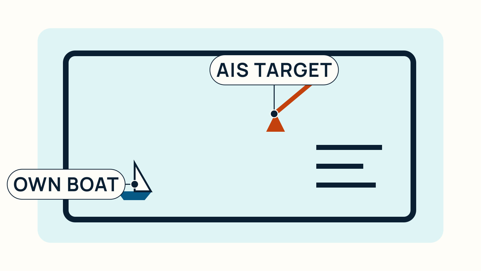
AIS, short for Automatic Identification System, is a VHF-based system that lets equipped vessels automatically share and receive data such as identity, position, course, speed, and navigational status. For a recreational sailor, it can make a busy screen easier to interpret and can help identify a ship you can see. It does not show every vessel, prove that a target's data is correct, or replace looking out of the boat.
Use AIS as one part of a layered watch. Look outside, listen, use your chart and local information, and compare what the screen says with what the water shows. That discipline is more valuable than treating any device as an answer machine.
Understand the information AIS can provide
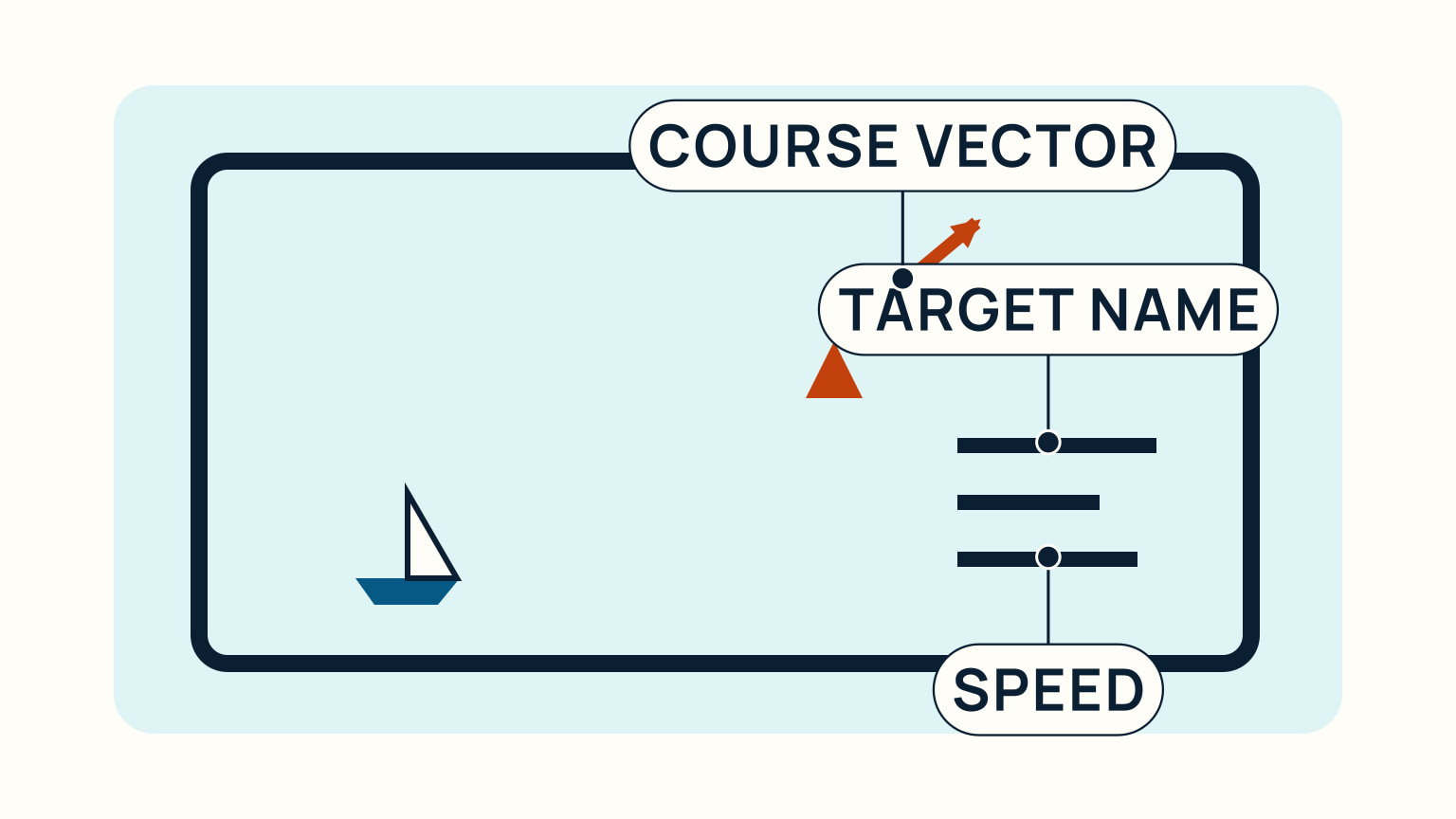
An AIS unit broadcasts reports automatically over the VHF maritime band. Other equipped vessels and shore facilities can receive those reports. Depending on the system and display, a target may show a name or identifier, vessel type, position, course, speed, status, dimensions, and related voyage information. The display may also calculate useful planning information such as closest point of approach.
That extra identity can change a vague sighting into a clearer conversation. Instead of calling "ship off my port bow," a sailor may be able to call a vessel by name when radio contact is appropriate. It can also help you recognise that several lights or radar returns belong to different vessels.
Treat the information as reported data, not as a command. Course and speed describe what the transmitting equipment says now. A target can manoeuvre, report imperfect data, or be displayed with a delay. Use its trend as a reason to look more carefully, not as a reason to stop looking.
For the basic planning context behind the screen, how to read a nautical chart explains why hazards, channels, depths, and aids to navigation still matter when a position icon looks reassuring.
Know what AIS does not show
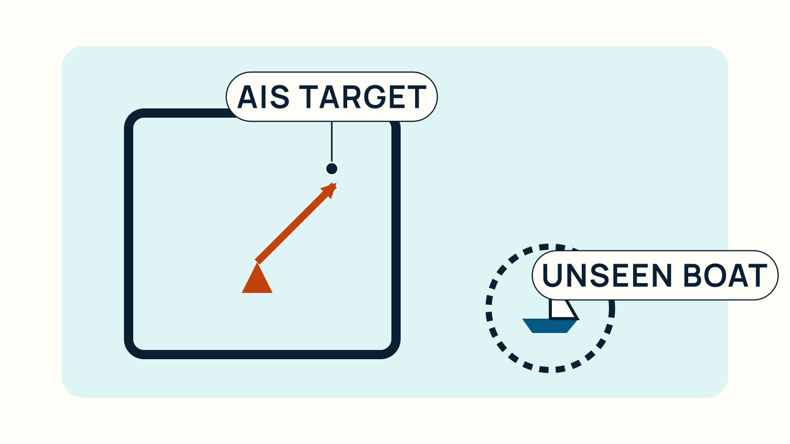
AIS is not a complete picture of traffic. Some vessels are not fitted with it. Some may not be transmitting in every circumstance. A receiver cannot display a vessel that sends no usable signal, and a symbol cannot tell you about every kayak, small craft, buoy, floating object, or hazard nearby.
The information received is only as accurate as the information transmitted. Errors in position source, settings, identity, course, or static details can make a screen convincing while still being wrong. Keep a healthy habit of asking whether the real vessel's bearing, aspect, lights, and movement agree with its target symbol.
Range and installation also matter. AIS uses VHF radio, so terrain, antenna height, interference, and local conditions can affect what is received. Do not assume that a blank sector has no traffic. Continue a proper visual and hearing watch, especially near land, in rain, haze, or crowded water.
The International Regulations for Preventing Collisions at Sea require a lookout by sight and hearing as well as all available means appropriate to the conditions. AIS adds an available means when you have it. It does not remove the rest of the obligation.
Choose the role AIS will play aboard
Some sailors want to receive AIS targets so they can see transmitting traffic. Others choose a unit that can also transmit the boat's own AIS information. The right setup depends on the boat, existing electronics, power system, antenna arrangement, sailing area, and applicable local requirements. Do not buy or install from a general article alone.
Start with the navigation job. Are you trying to identify commercial traffic in open water, improve awareness in a busy approach, or add a second source of information to an existing radar and chart display? Then ask how the unit will connect, where it will be viewed from, and who will keep its data accurate.
If a unit transmits, its programmed identity and static details must be correct. A wrong boat name, dimensions, or position source creates bad information for others. Follow the current manufacturer instructions and your local radio and registration rules. Those requirements vary, so no country should be assumed as the default.
AIS works best when the person at the helm can see it without abandoning the real lookout. Think through night use, glare, alarms, and screen clutter before the first trip. A device that constantly distracts the watchkeeper is not helping.
Make AIS part of a collision-avoidance routine
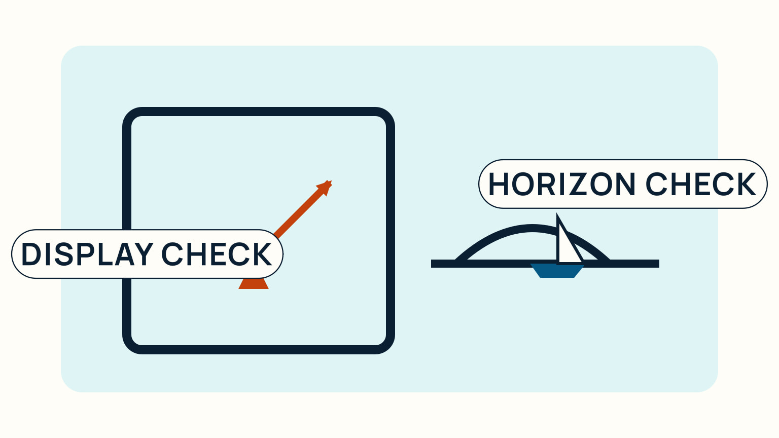
When a target appears, first look outside and establish what you can see. Check its bearing over time, relative movement, lights or shape when relevant, and whether it agrees with the AIS presentation. Then use the chart and your own course to understand where the encounter is developing.
If the situation needs action, make it early and clear under the collision regulations. Do not use an AIS name as a reason to negotiate away safe seamanship. A radio call can be useful, but it should not be the only collision-avoidance plan. The other vessel may not answer, may misunderstand, or may be managing a different hazard.
Keep alerts meaningful. A screen full of alarms trains people to ignore them. Set up the display and target filters in a way you understand, then practise interpreting it in quiet water. Explain the basics to everyone who may take a watch: a triangle or icon is a report about a vessel, not the vessel itself.
AIS becomes even more useful when paired with the fundamentals in boat navigation lights and VHF radio basics. One helps you identify what you see; the other helps you communicate when communication is genuinely needed.
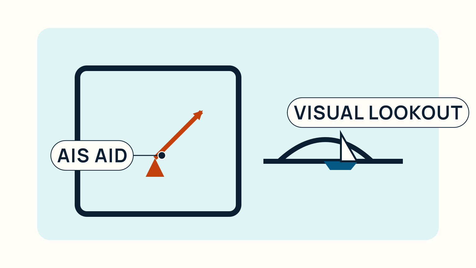
AIS can give a recreational sailor useful names, positions, and movement clues. The safe way to use it is straightforward: trust it enough to investigate, then confirm the situation with your eyes, ears, chart, and judgement.
Make a small watch routine before traffic becomes close. Identify the nearest relevant targets, then look out and confirm which visible vessel matches each one. Recheck after a course alteration or a change in visibility. If a symbol and the outside view disagree, do not force them to match in your mind. Treat the disagreement as the important information and slow the situation down with more observation. That habit keeps useful AIS information from becoming a source of false certainty.
At the end of a watch, check the equipment as part of the boat's normal readiness routine. Confirm that the display, antenna connection, position source, and power arrangement are behaving as expected. If your unit transmits, make sure the programmed vessel details are still correct after any refit or ownership change. A device that is installed but not understood or maintained is less useful than a simple, well-practised lookout routine.
Use AIS names carefully on the radio. Identify the vessel from the real situation first, make a concise call only when it helps, and never assume the other vessel is listening or agrees with your interpretation. A clear early manoeuvre remains the most reliable way to avoid a close situation.
Review the display after a quiet trip too. Which targets were useful, which alarms were distracting, and which information did you confirm visually? That small debrief helps you tune the equipment around the way you actually sail rather than around a generic demonstration.
Record an unfamiliar alert and check its meaning in the unit's manual after the watch.
Use a sensible display scale for the decision in front of you. A wide range can show the wider traffic pattern but make a nearby small target hard to interpret. A close range can show detail while hiding where that vessel came from or where it may go next. Change range deliberately, and return to the outside view after each change. The equipment supports the watch only when the watchkeeper can still connect its symbols to real boats and water.
Keep onboard expectations realistic when guests see an AIS screen. Explain that it is useful for equipped transmitting vessels, not a map of every object afloat. Ask a second person to point out visible traffic or read a chart rather than simply watching icons. Sharing the watch in this way can make an electronic aid more useful while preserving the habit of looking outward.
Before relying on a new installation, read its manual and learn how it behaves when GPS input, VHF reception, or power is interrupted. A unit may show an alert or a stale target in a particular way. Understanding those normal failure signs helps prevent a missing symbol from being mistaken for an empty sea.
Try it from the lesson
Can you spot the next move?
On a NOAA paper chart, you see buff, green, and blue close to shore. What does each colour mean?
Why you can trust this guide
. We build each guide from public seamanship and safety sources, then teach the universal principle before any local difference.