Chart your course
How to Time a Harbor Entrance
Quick answer
The short version
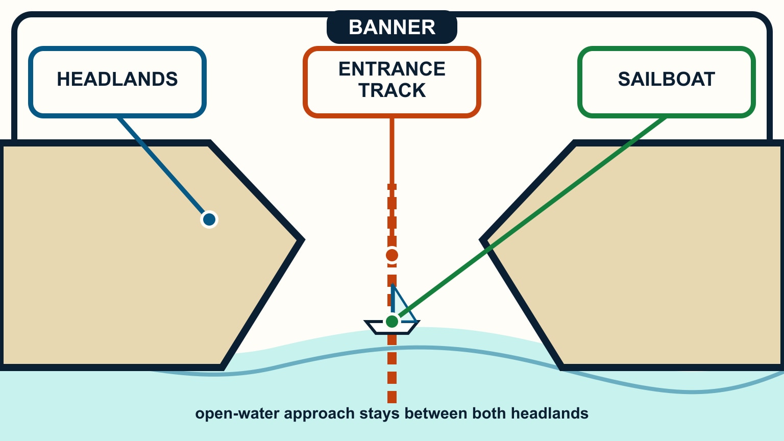
Time a harbor entrance from its controlling risks, not from high water alone. Confirm current charts, sailing directions, local notices, harbour instructions, weather, tide height, and tidal-current predictions. Calculate depth over the shallowest controlling point with draft and a margin. Check current separately because slack water does not universally coincide with high or low tide. Then test wind against current, waves at the bar or breakwaters, visibility, daylight, traffic, and the boat's ability to stop or turn. Choose a commitment point, a safe waiting area, and an alternate harbour before departure. Recheck everything at the approach and leave if the observed water disagrees.
An entrance concentrates several small errors into a short piece of water. A favourable tide height may add depth while an opposing current makes the surface steep. A fair offshore forecast may hide breaking waves at a shallow bar. Build the approach as a short coastal pilotage plan, with one decision at a time.
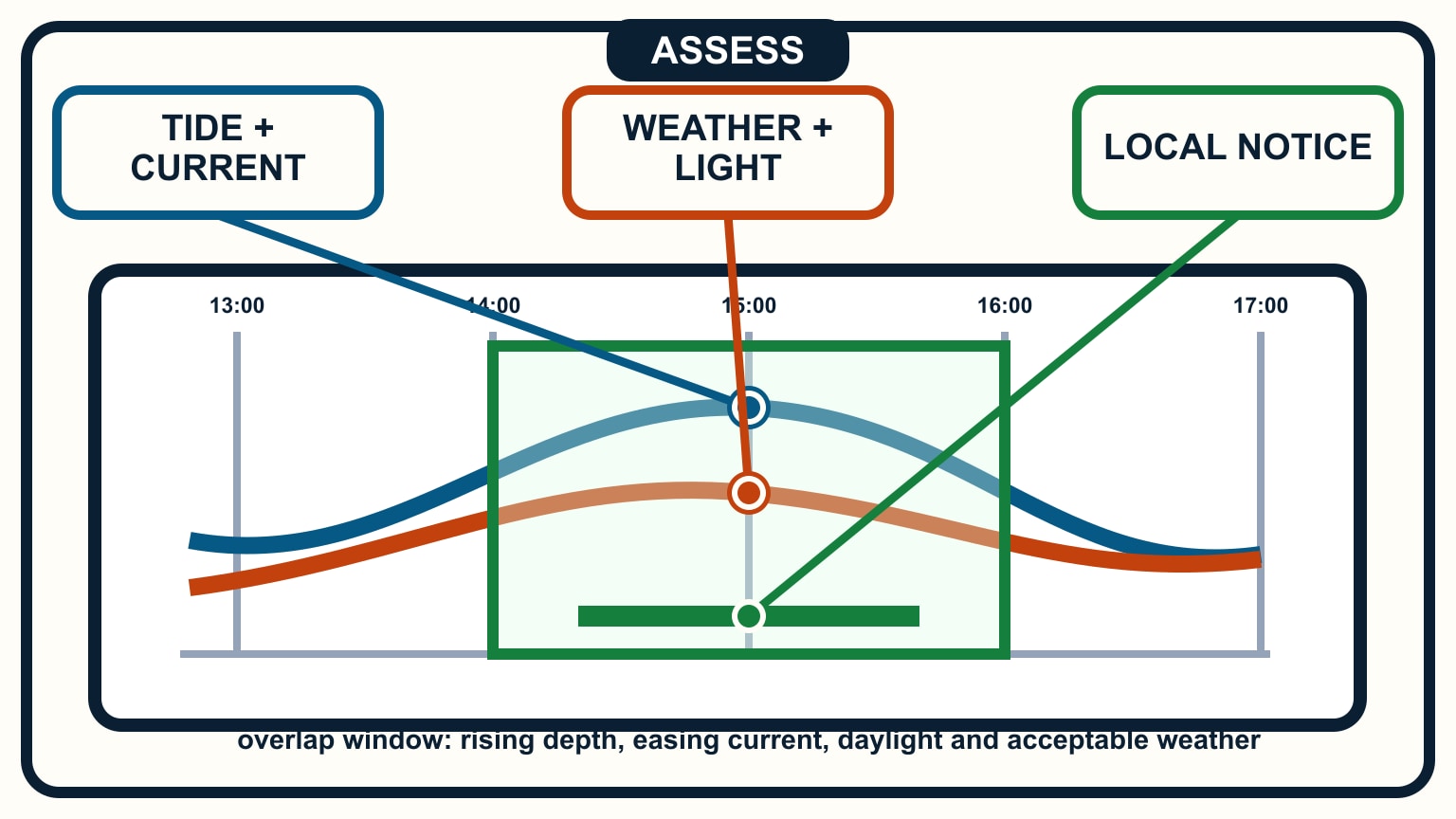
Define the usable window from local information
Read the harbour's current entry guidance. Look for controlling depth, dredged-channel limits, current behaviour, bars, bridges, locks, reporting points, traffic signals, speed limits, and any daylight or weather restriction. Verify current local rules. A waypoint and tide-table screenshot are not a harbour brief.
Identify the official tide and current stations that apply. NOAA explains that the relationship between high or low water and maximum or slack current is unique to each location. Predictions are published separately for a reason. Use any official time and height corrections required for the entrance rather than borrowing the nearest convenient port.
Add the forecast and warnings for the coastal area, then seek local observations near the entrance. Wind direction matters relative to current and the channel. Visibility, swell direction, recent rain or river flow, and a changed bar can matter even when the predicted height is adequate.
Turn those facts into a broad window, not a single minute. Include time to identify marks, wait for traffic, and make another approach. If a bridge, lock, or marina imposes a fixed time, work backward from it and leave margin rather than racing the last leg.
Prove depth at the controlling point
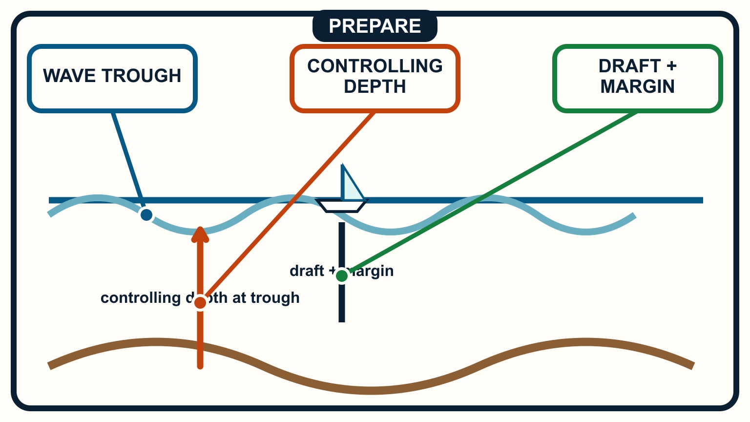
Find the shallowest charted depth along the route and confirm whether the entrance has a maintained or reported controlling depth. Combine it with predicted tide height referenced to the same datum. Subtract the boat's maximum draft and an allowance for waves, squat, survey uncertainty, silting, and local conditions. Chart datum, tide height, and water depth shows the signed arithmetic.
Check the time basis and units. A tide listed in local standard time can move by an hour when the crew assumes daylight time. A chart in metres and a boat specification in feet can produce a plausible-looking wrong answer if units disappear from the notes.
Depth is a corridor, not a waypoint. Plot enough width to account for steering, current, and position uncertainty. Mark where the bottom shoals outside the channel and which side offers known safe water if the boat drifts. At a bar, the wave trough reduces the water available under the keel even while the mean level looks adequate.
Set a minimum observed depth based on the sounder's real offset. If the display reaches that limit earlier than expected, slow and turn toward the planned safe water. Do not continue simply because the predicted calculation said the channel should be deeper.
Hold the planned line with visible evidence
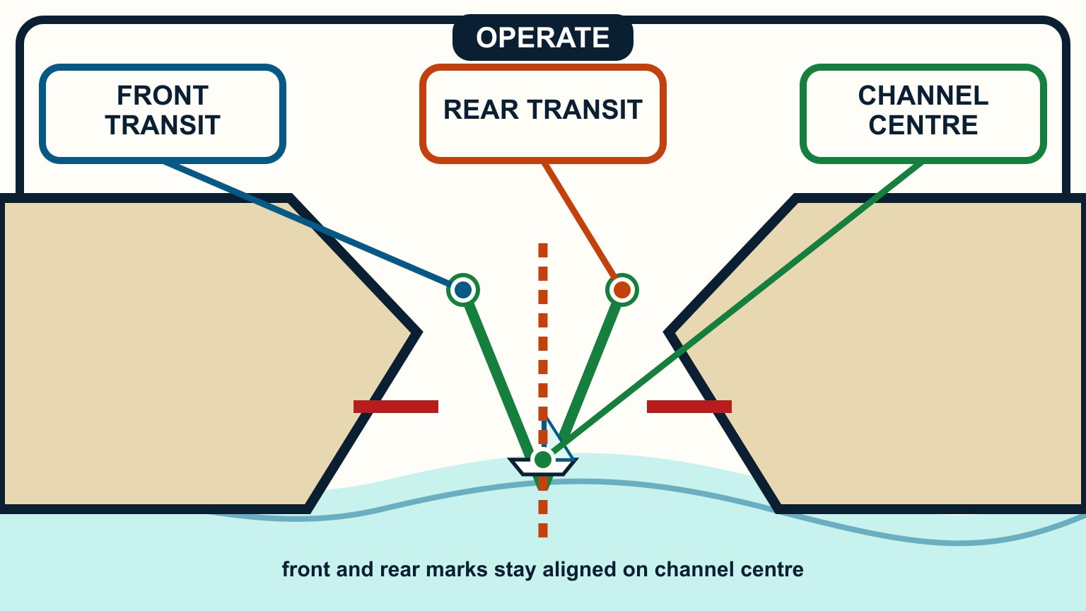
Choose an entrance transit, leading marks, buoy sequence, or conspicuous charted features that define the route. A transit gives immediate lateral feedback: if the rear mark moves to one side of the front mark, the boat has left the line. Confirm the marks from outside the entrance and know which safe correction follows each opening.
Keep an electronic route as a cross-check, not the only source. Verify every waypoint against the updated chart at a useful scale. Position can lag or be offset, a buoy may be moved, and a screen cannot show how breaking water is changing ahead. Maintain a lookout for traffic, fishing gear, floating debris, and local signals.
Plan speed before commitment. The boat needs steerage, yet excessive speed reduces decision time and can increase squat. Use the engine and sail configuration appropriate to the boat and conditions. Prepare lines and fenders without sending crew onto an exposed foredeck at the worst point.
Brief radio calls and collision-avoidance responsibilities. A harbour instruction never removes the duty to keep a proper lookout or take safe action. If another vessel blocks the planned line, hold only in the pre-checked safe area or leave for another attempt.
Treat wind against current as a separate gate
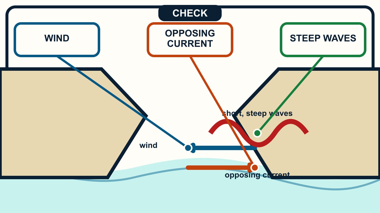
When wind opposes current, waves can become steeper and closer together, especially where water shoals or funnels through a narrow entrance. The effect can be far worse than either the wind forecast or current number suggests alone. Look for breaking crests, standing waves, spray, and vessels pitching sharply ahead.
Compare observations from the entrance with the forecast. A camera, harbour report, nearby buoy, or local traffic can help, but direct water is the final check. Conditions may also differ on the return trip after current turns. Record both direction and rate rather than writing only “favourable tide.”
Decide the limit in advance: a stated wave condition, loss of visual marks, depth below the margin, current above the boat's controllable ability, traffic conflict, or a missed time. The limit should trigger a known response without a cockpit debate inside the breakwaters.
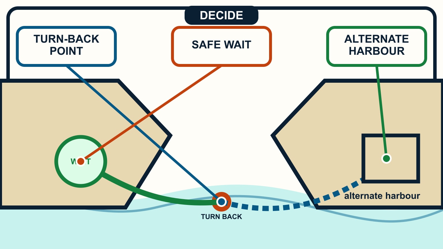
If the entrance is unsafe, use the alternate or wait in the charted holding area. Waiting close under an exposed shore or directly in the approach lane creates a new hazard. Sailing in tidal waters helps separate vertical tide from horizontal current before this decision becomes time-critical.
Keep the turn-back option open
Mark the last point where the boat can turn in known depth without entering breaking water, a traffic lane, or a lee shore. Approach it at a speed and angle that preserve the turn. If the engine, steering, marks, or depth are not behaving normally, leave before passing that point.
The alternate must remain viable at the actual arrival time. Recheck its depth, weather exposure, current, daylight, and services. A marina that has closed or an anchorage exposed to the same wind is not an answer. Share the alternate and latest decision time with the crew and shore contact.
After entering, keep navigating. Inside-water shoals, cross traffic, ferry wash, bridge clearance, and berth approach may be the next constraints. Do not let relief at crossing the entrance end the lookout. Log the observed current, minimum depth, marks, and anything that differed from the published plan.
Use that record for the departure plan, but update it. Current reverses, tide height changes, visibility falls, and harbour notices move. Familiarity is useful only when it sharpens the checks rather than replacing them.
SailStarter's navigation and weather lessons give you the pieces behind a harbour window. Combine them on paper before the approach: water under the keel, water moving sideways, wind and waves, visible marks, traffic, and a route back out. If one piece remains unknown, slow down while still outside. The best-timed entrance is not the one closest to a predicted high tide. It is the one where the boat has depth, control, visibility, and an unused exit.
Brief the approach as a sequence with named abort points. The helm should know the intended track and safe speed; the navigator should call cross-track change, depth trend, and the next visual mark; another crew member should monitor traffic and radio. Decide which observation cancels the entry and where the boat will go next. “We will see when we get there” is not an abort plan.
Recalculate if the passage is delayed. The tidal height, current phase, daylight, traffic, and forecast may all have moved since the morning plan. Confirm that the proposed waiting area is safe in the new wind and sea state; milling near an entrance can be worse than diverting early. If local advice, a harbour closure, visibility, breaking seas, or the crew's condition removes the margin, use the alternate and notify the relevant shore contact.
After a routine entry, record the exact actual time, observed depths, current set, transit appearance, and any radio instruction. Keep personal notes clearly separate from current official information so they help the next plan without becoming an unofficial chart.
Try it from the lesson
Can you spot the next move?
You steer a heading straight for a can buoy dead ahead, with a 2-knot stream pushing across your port beam. After an hour holding that heading, are you at the buoy?
Why you can trust this guide
. We build each guide from public seamanship and safety sources, then teach the universal principle before any local difference.