Chart your course
Sailing in a Squall: What to Do When the Sky Turns Fast
Quick answer
The short version
Sailing in a squall comes down to one drill, run in order, before the wind actually arrives: shorten sail early, get your PFD on, secure anything loose, put your steadiest hand on the helm, and expect the wind to shift without warning. A squall itself is a sudden, sharp jump in wind speed (meteorologists define it precisely: an increase of roughly 16 knots or more building to a sustained 22 knots or better, lasting a minute or longer), and it forms under or ahead of a developed thunderstorm cloud. The detail that catches sailors out: the wind reaches you before the rain does, so waiting for rain to confirm a squall is real means waiting until it's already on you. Once you know the signs, you have time to prepare properly.
A clear afternoon can turn violent within minutes once a thunderstorm cloud builds nearby, and a squall's first gust can hit hard enough to knock a boat flat before a single drop of rain has fallen. That's the trap: rain feels like confirmation, but by the time it arrives, the wind that actually mattered has already tested you. The good news is that a squall telegraphs itself well before the wind does, if you know what to watch for and you're willing to act on it early rather than wait and see. The rest of this covers what actually counts as a squall, why the wind always beats the rain to your boat, the visible signs that tell you one is coming, and the concrete drill: in the right order: for getting your boat and crew ready before it arrives.
What Actually Counts as a Squall
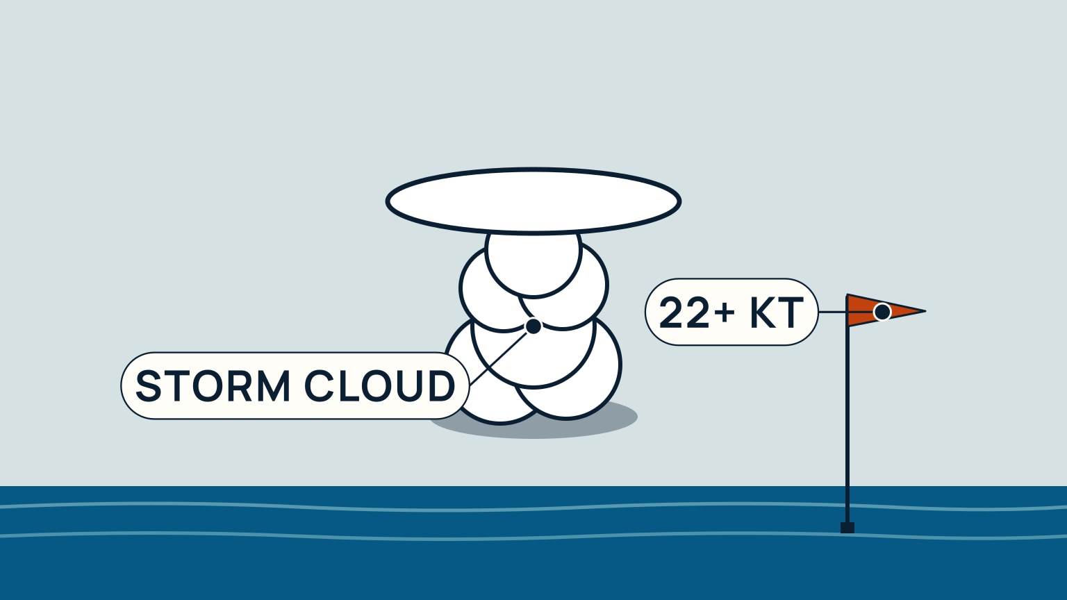
Not every gust is a squall. Meteorologists give the word a precise threshold rather than a vague impression of "windy": the US National Weather Service's glossary defines a squall as wind speed that jumps at least 16 knots and holds at 22 knots or more for a full minute or longer. The World Meteorological Organisation's own figure, independently reported, lands in the same range in different units (roughly 8 to 11 meters per second, sustained for at least a minute).
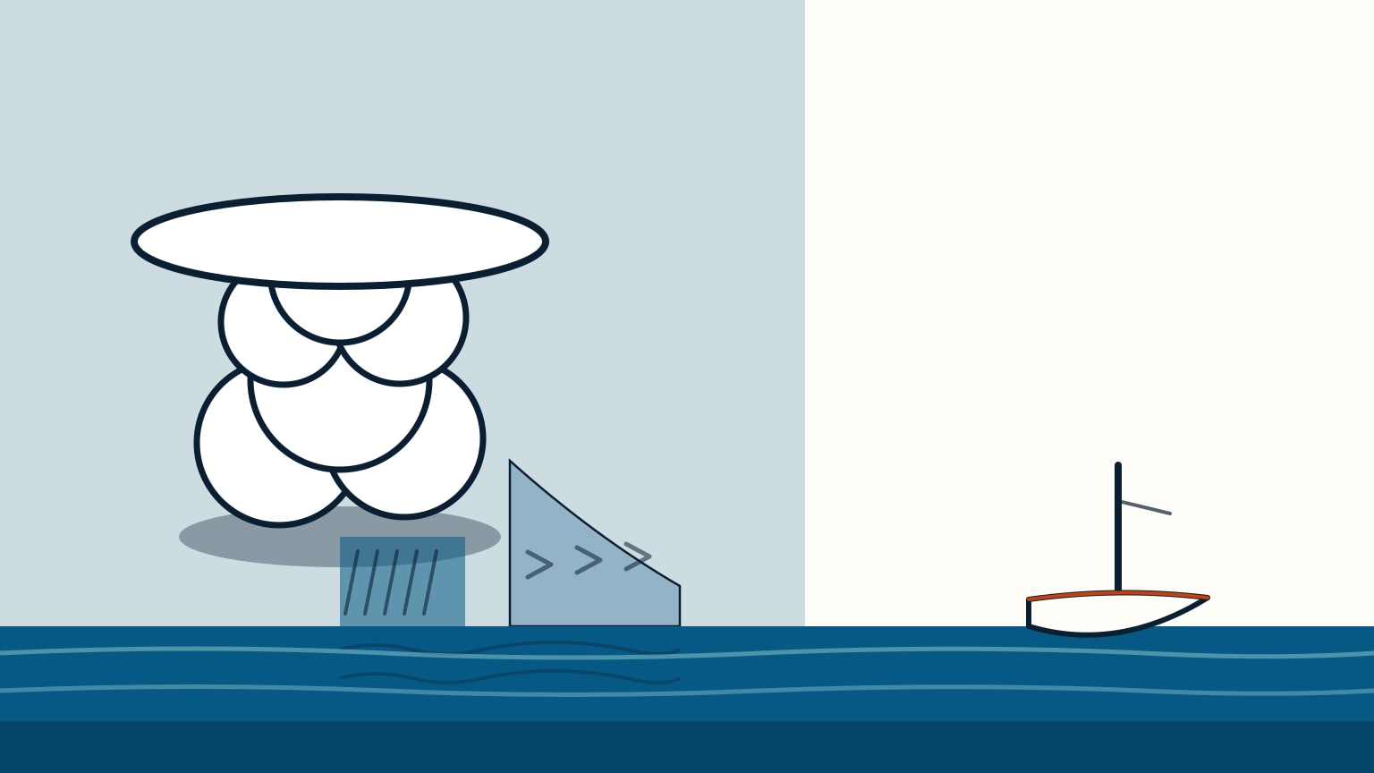
A squall forms under or ahead of a developed thunderstorm, or cumulonimbus, cloud. It's that cloud's own cold downdraft air, spilling out at the surface, that drives the wind you're about to feel. A single storm cell, or a whole line of them merged together, can keep producing squalls for hours as the system travels. But its punch at any one spot (your position) passes quickly: a rapid jump in wind and weather, followed by a fairly rapid return to normal. That's a real, if brief, event, not a permanent change in conditions.
Why the Wind Reaches You Before the Rain
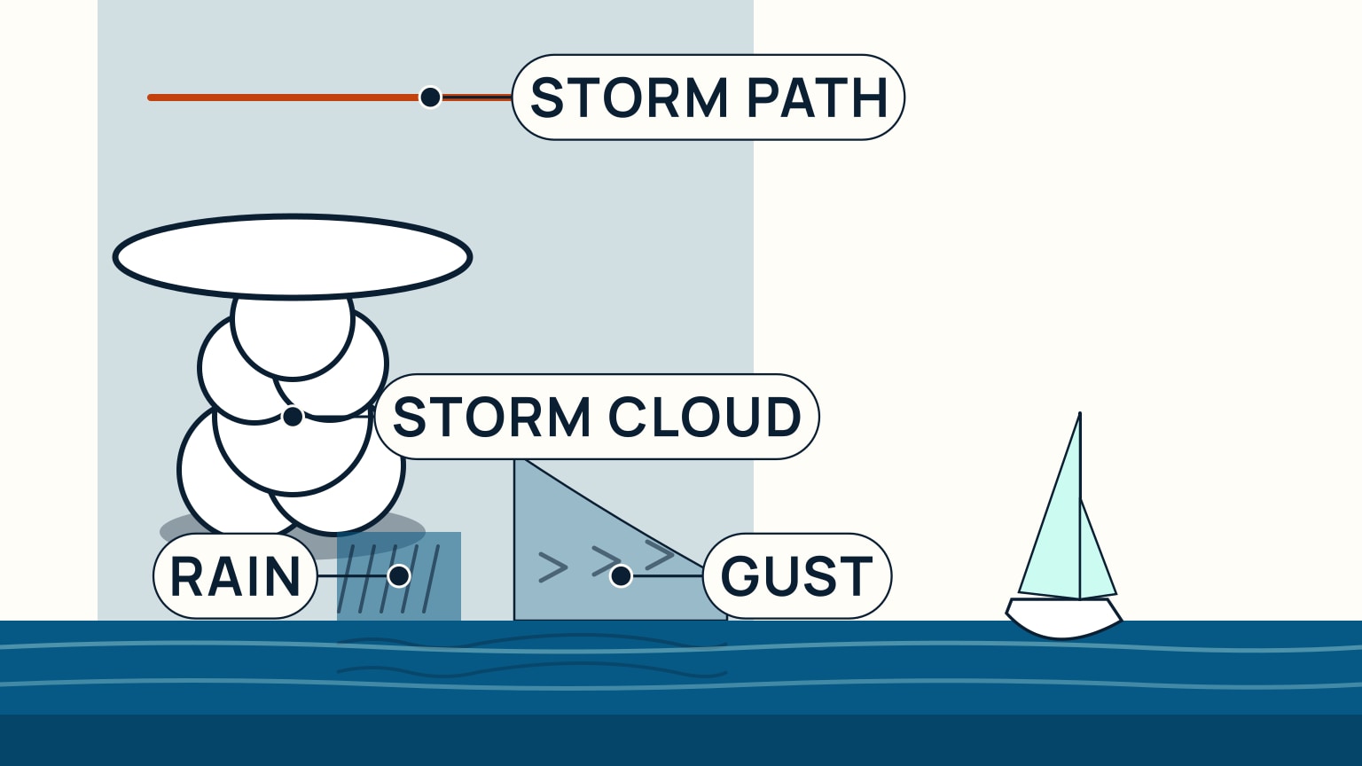
One detail is worth remembering precisely: a squall's wind gets to you before its rain does. Inside a thunderstorm cloud, cold downdraft air plunges toward the surface, and once it hits, it spreads out in every direction, including out ahead of the storm's own direction of travel. That leading edge of outflow wind is called the gust front, and it can produce strong, gusty surface winds well in excess of 40 knots. The storm's own rain-producing body trails behind it.
Because the gust front is pushed out ahead of the rain, a boat in the storm's path feels the wind first and the rain second, sometimes minutes apart. Waiting to feel rain, or see it start, before shortening sail means you're already sailing in the wind that was supposed to be your cue to act. Once the squall line has passed, the air behind it is noticeably cooler and drier. That's a physical marker that the worst of it has gone through.
Read the Signs Before It Arrives
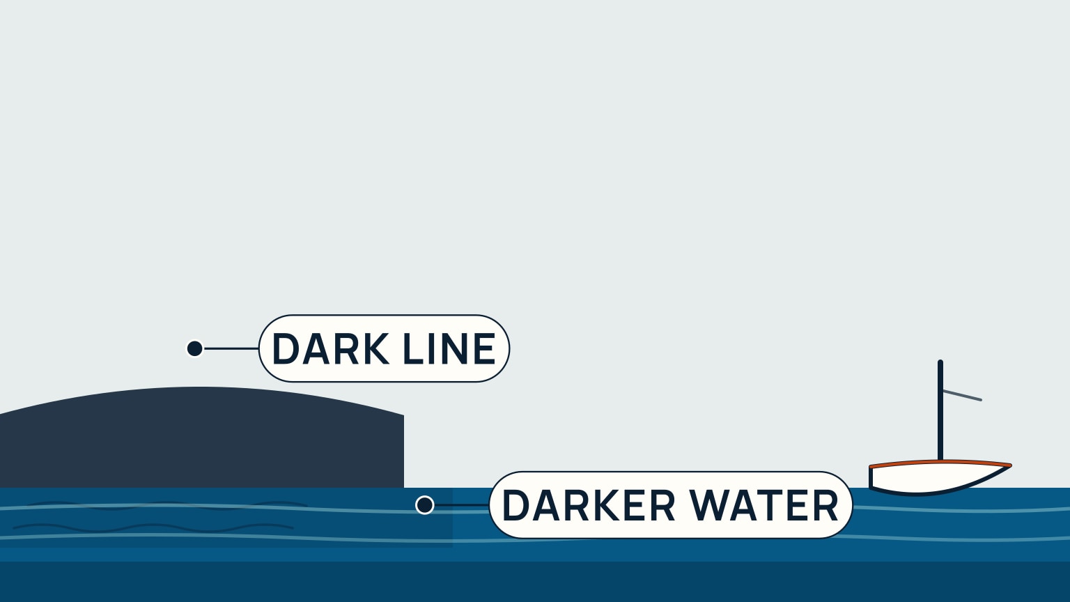
A squall gives you a preview if you're watching for it. From a distance, an approaching cell shows up as a dark, advancing line or a low, shelf-shaped cloud along the storm's own leading edge. It's visible well before it's overhead, usually with enough lead time to prepare, if the sky is being watched. Closer in, the sea surface itself changes first: it darkens, and a band of small ripples starts running across the water ahead of any wind you can feel on your own skin.
Any one of these signs is worth acting on. Together (the dark line, the advancing rippled water, and then a sudden, noticeably cooler gust as the outflow air actually reaches you), they're unmistakable. None of them require instruments or a forecast update; they only need you looking up and out, regularly, while you're underway.
The Drill: What to Do, in Order
Set triggers before the dark cloud arrives
Use the forecast, radar or observations available, and the sky to decide what will trigger action. A rapidly darkening cloud, rain shaft, gust front on the water, sharp wind shift, falling visibility, thunder, or nearby lightning may justify shortening sail or changing the route before the squall reaches you.
State the trigger during the crew brief: “If that cell continues toward our track, we reef and turn toward clear water.” Assign helm, sheets, halyards or reefing controls, lookout, and navigation. Put on suitable flotation and weather gear while movement is still easy. Close or secure openings and loose gear.
Reduce work before the first gust
Reef or change sail by the boat's established procedure early. Start the engine only when appropriate and after checking lines and cooling requirements. Create sea room from shore, shoals, traffic, and other hazards. Choose a heading that the boat and crew can hold if visibility falls.
Avoid sending crew forward at the peak unless the safety need demands it. Keep people clipped or positioned according to the boat's plan, and maintain communication. The first gust can arrive before heavy rain, so waiting for rain as the signal uses up preparation time.
The Beaufort guide helps read the broader sea state, but a squall is a rapid local change. The true and apparent wind guide explains why the load can change again when you alter course.
Navigate through and after the squall
Maintain lookout and track position. Rain can hide boats, shore, and marks. Avoid a large course change until you have checked the space around the boat. If lightning is present, follow current authoritative guidance and the boat's electrical and emergency procedures.
After the main gusts pass, do not immediately restore full sail. Check the next cell, wind trend, crew condition, lines, sail, rig, bilges, and engine. Confirm position and route. The wind may shift, fall sharply, or build again behind the rain.
Debrief the trigger and timing. If reefing became rushed, move the trigger earlier next time. If the boat lost room, revise the route decision. A squall drill succeeds when it creates time and options before conditions remove them.
Once you see the signs, run the drill, in this order, before the first gust arrives. Reef or drop sail early, while there's still time. Don't wait for the wind to prove you should have. Get your PFD on before the weather actually reaches you. Secure anything loose on deck or below; it will move once the boat starts moving. Put your most capable hand on the helm, since steering the first, hardest gust takes both strength and quick judgment. Expect the wind to shift, sometimes abruptly, and stay ready so it doesn't catch you into an unplanned jibe or tack.
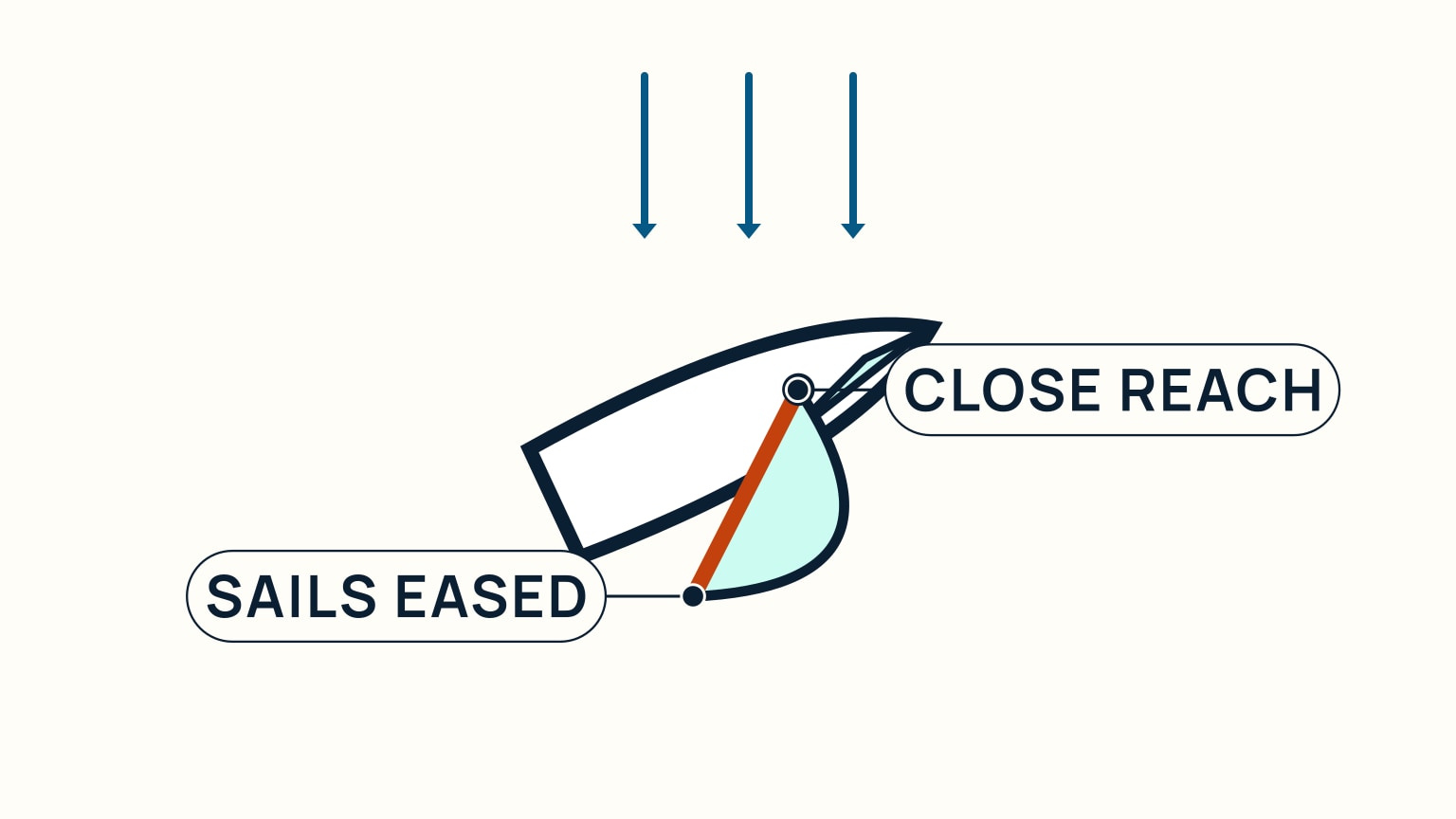
If it's building faster than you can comfortably handle underway, get to the safety position (a close reach with sails eased, turning toward it from whatever point of sail you're already on) or heave to, and let the worst of it pass. Fix your position before visibility drops, since heavy rain can cut it sharply. Once the squall has gone through, shake the reef back out and carry on.
The drill is short, and every step in it has a reason behind it, so it stops feeling complicated once you've practiced it a few times. What takes real preparation is recognizing the moment to start: the dark line on the horizon, the darker water running ahead of the wind, the first cool gust. SailStarter's lesson on squalls walks through the same recognition cues and response drill as a tap-through interaction, building on the cloud-reading skills for spotting an approaching thunderstorm and the reefing and heaving-to techniques you'd actually use once the wind hits. If you sail anywhere that builds afternoon thunderstorms, this is worth having down cold before you need it, not mid-squall, when there's no time left to look anything up.
Try it from the lesson
Can you spot the next move?
You spot a dark line on the horizon, moving toward you. What's the first move?
Why you can trust this guide
. We build each guide from public seamanship and safety sources, then teach the universal principle before any local difference.