Chart your course
What Causes a Sea Breeze?
Quick answer
The short version
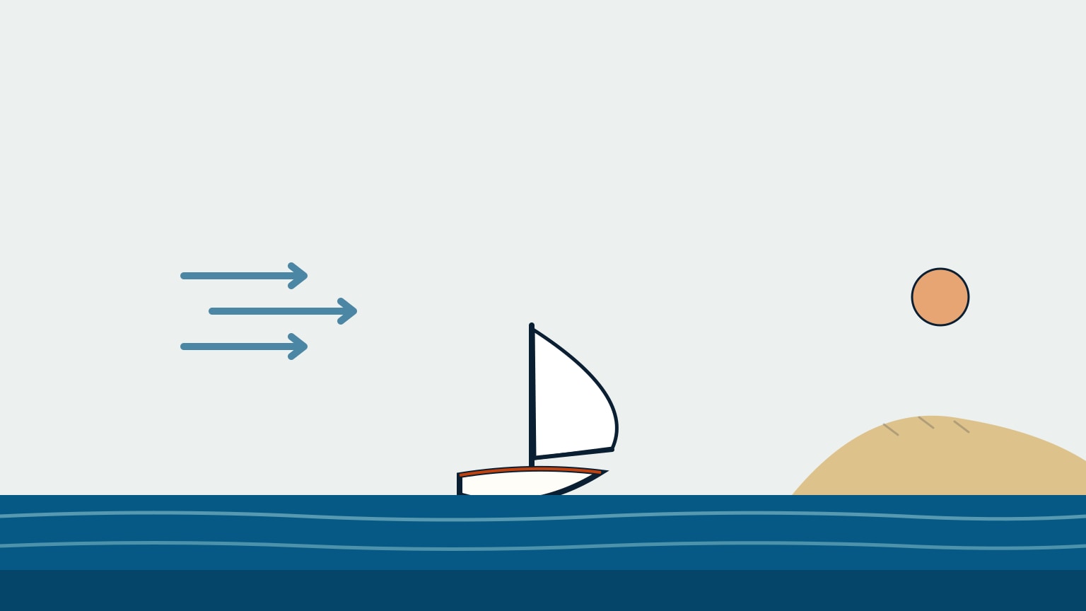
A sea breeze is caused by the land and sea heating up at different rates. On a sunny day, the land warms up far faster than the water beside it, because the sea can absorb far more of the sun's heat without its surface temperature climbing nearly as fast. The air sitting over that now-warmer land becomes lighter and rises, and that leaves lower pressure right at the surface over the land. Cooler, denser air sitting over the sea flows in to take its place. That inflowing surface wind, blowing from sea to land, is the sea breeze. It's a local, sun-driven wind, not a passing weather system, and it can start up on a morning that looked completely calm.
Two national meteorological services describe the same mechanism independently, which is a useful sign it's solid, everyday physics rather than a rule of thumb. Once you can picture what's driving it, a sea breeze stops being a mystery and turns into something you can plan a sail around, including the part that catches a lot of beginners out, which is what happens on the way back in. This walks through the mechanism, the full circulation it's part of, its rough daily rhythm, and what happens once the sun goes down.
How a Sea Breeze Starts
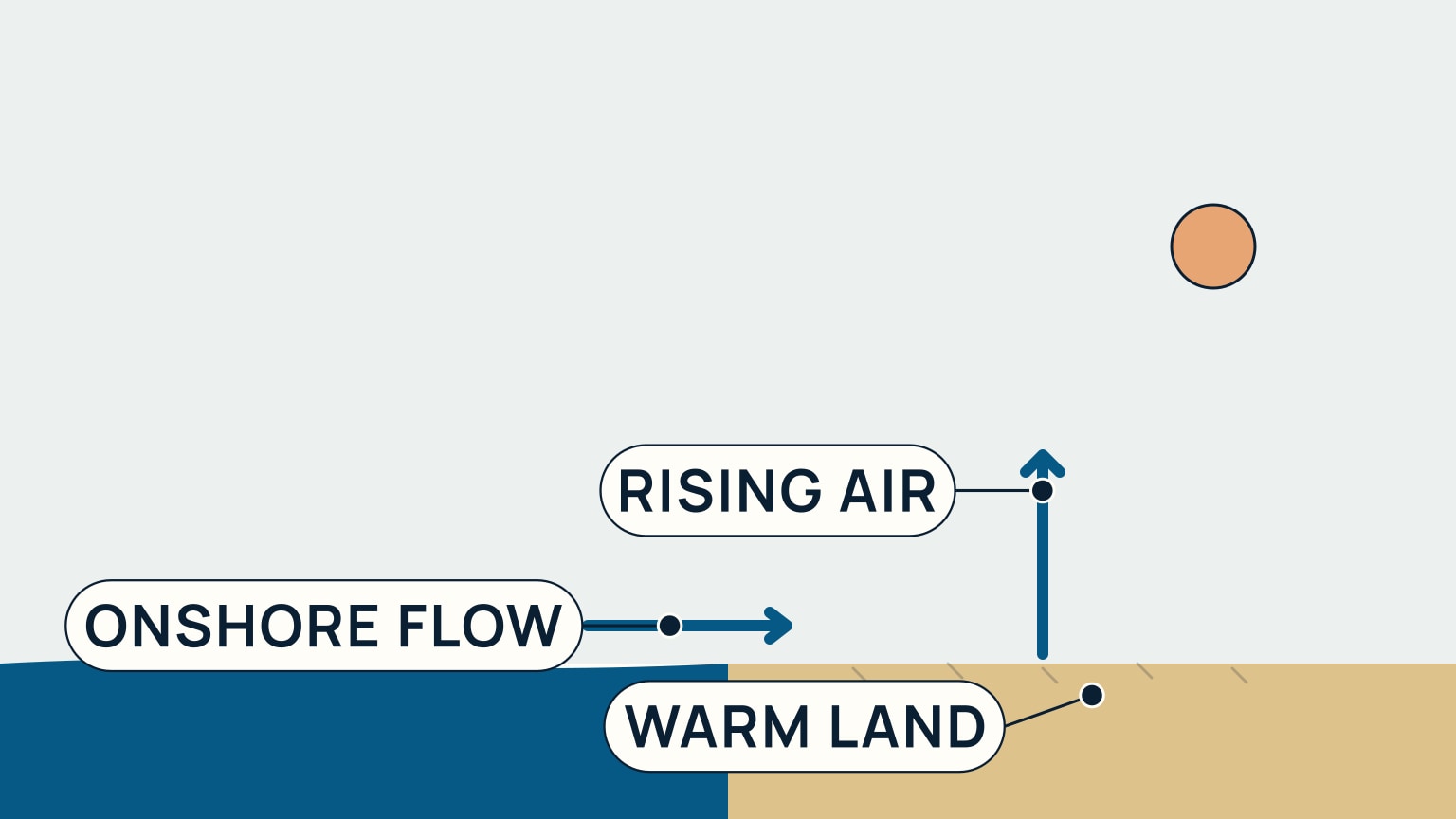
On a sunny day, land heats up far faster than the sea beside it. The UK Met Office puts it plainly: the sea "has a greater capacity to absorb the sun's rays and is more difficult to warm up," which sets up a real temperature contrast between the warm land and the cooler water next to it. The air sitting over that now-warmer land becomes less dense and starts to rise, and as it lifts away it leaves lower pressure behind at the surface. The air over the sea stays cooler, denser, and at relatively higher pressure, and air moves from higher to lower pressure, so it flows in from the sea to replace what's rising over the land. That inflow, blowing from sea to land, is the sea breeze.
The US National Weather Service corroborates the same mechanism independently, defining a sea breeze as a thermally produced wind "caused by the difference in the rates of heating of the surfaces of the ocean and of the land." Two services, describing the same cause from opposite sides of an ocean, is exactly the kind of agreement that separates real physics from a sailing myth.
The Full Circulation Loop
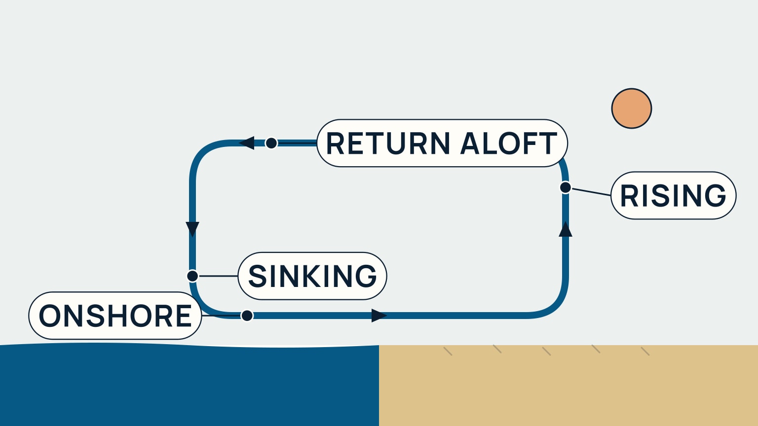
That inflow at the surface is only half the picture. Air can't simply pour in from the sea forever without somewhere to go, and the UK Met Office's own diagram of a sea breeze draws the whole loop: the land heats up faster than the sea and the air over the land rises; air rushes in at the surface to replace what just rose, flowing in from the sea; higher up, that same air flows back out from over the land toward over the sea; and it cools and sinks back down over the water, ready to flow onshore again at the surface. Four legs, one continuous circuit, not a single arrow pointing at the beach.
There's a pressure pattern behind it too: higher pressure sits over the sea, lower pressure over the land, and the whole loop is the atmosphere working to even that difference back out. It keeps running as long as the land keeps outpacing the sea in the heat department.
Building Through the Day, Fading by Evening
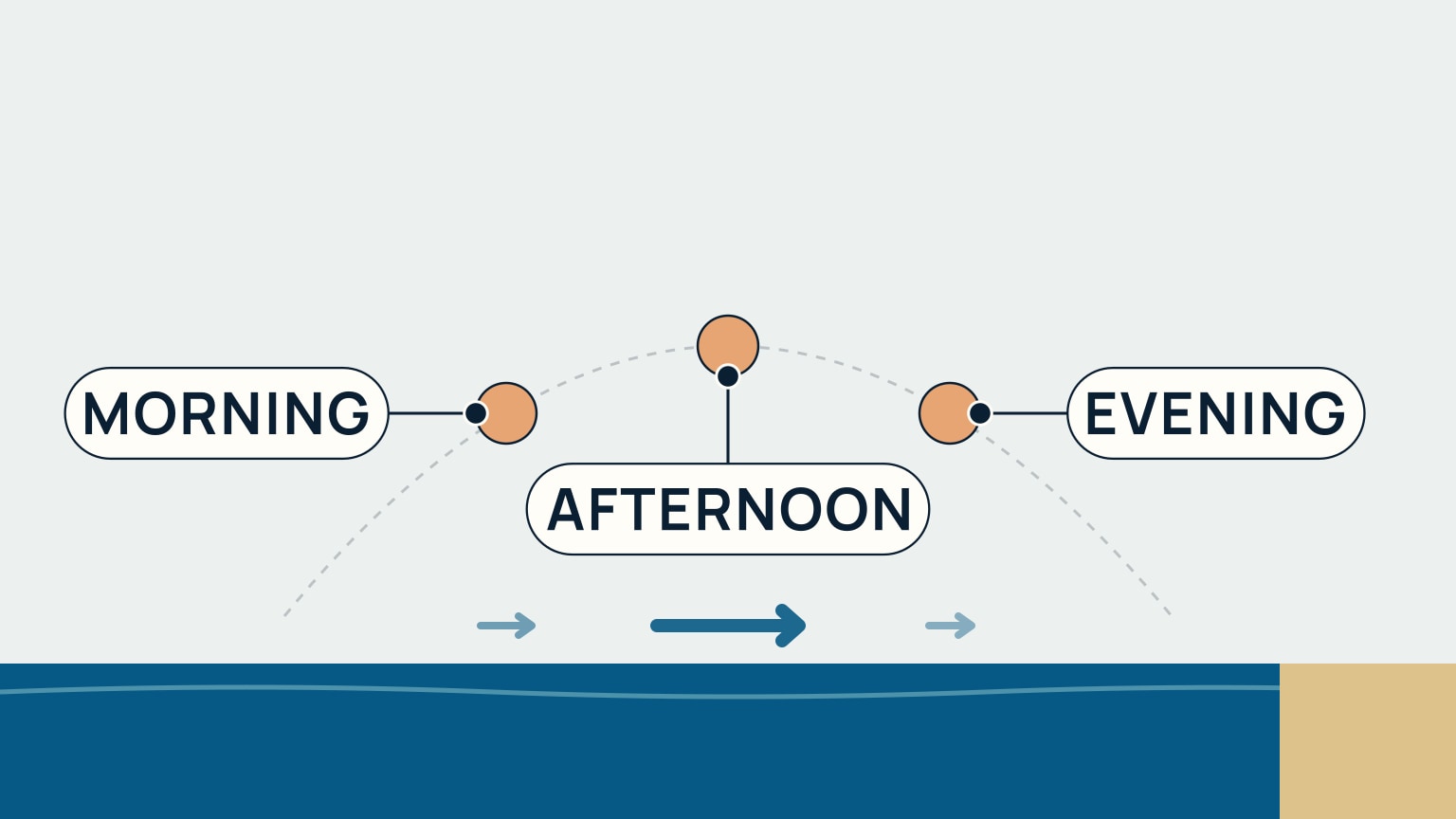
A sea breeze follows the sun's own heating, so its timing isn't fixed to a clock. The UK Met Office describes sea and land breezes developing generally "on sunny days during the summer," and, for tropical coastal climates specifically, notes onset "from late morning": a climate-scoped detail, not a universal start time. As the land keeps gaining heat through the day, the temperature difference driving the breeze tends to keep building too. US forecaster-training material corroborates that the surface heating behind it peaks in the afternoon, which is why the push is usually strongest then. By evening, once the land stops gaining heat, the breeze fades and the wind reverts toward whatever was blowing before it started.
That build-up is exactly what catches sailors out: a morning that looks flat calm on the water can turn into a real, steady afternoon breeze once the land's had a few hours of sun on it, so plan the return leg as carefully as the trip out.
After Dark: The Land Breeze
Use the cycle as a planning clue
Check the synoptic forecast first because a strong larger-scale wind can weaken, delay, strengthen, or redirect the local sea-breeze pattern. Then compare morning observations with the expected daily heating. Clear sunny conditions and a large land-water temperature contrast support the circulation, while cloud and an opposing background wind can change it.
Near midday and afternoon, watch for a wind increase or direction change from the water, a line of cloud inland, changing haze, and a sharper wind boundary. The exact timing and strength depend on coastline shape, terrain, background wind, and local weather. Use local forecasts and observations rather than treating one clock time as universal.
Plan both legs of a coastal sail
A calm morning departure may become a stronger afternoon return. Choose sail area, crew, and route with that possibility in mind. Keep enough sea room for a direction change and reef before a building breeze makes the work difficult. The Beaufort guide helps turn increasing whitecaps into a live strength estimate.
Course changes also alter apparent wind. A sea breeze that feels light while sailing with it may feel much stronger after turning toward home. The true and apparent wind guide explains that difference.
Do not treat the evening reversal as guaranteed
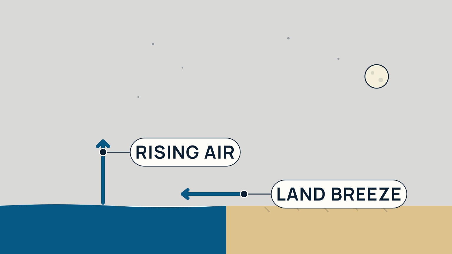
After sunset, land often cools faster than water. The daytime circulation weakens, and a lighter offshore land breeze can develop when the pressure pattern supports it. Terrain can channel or block that flow, and the background weather may overwhelm it completely.
If the plan depends on an evening fade or reversal, verify it with the current forecast and observations. Keep a route that remains safe if the sea breeze lasts longer or the wind goes calm. A local thermal cycle is a useful expectation, not a promise.
Record what happened at the same coastal area over several visits: cloud, morning background wind, onset time, direction, peak, and evening change. That local evidence helps you interpret the next forecast without replacing it.
Keep the observations in the sailing log with the route and sail changes.
Note whether the breeze reached sheltered water later than the exposed coast.
After sunset, the pattern flips. The land loses its heat quickly once the sun is gone, while the sea holds on to its warmth for longer, so the relatively warmer sea becomes the side where air now rises. The loop the Met Office's own night diagram draws runs in reverse, with the surface flow now blowing from land to sea. The US National Weather Service independently corroborates the reversal, describing a land breeze as driven by "the difference in the rates of cooling" of the two surfaces, rather than their heating.
A sea breeze also never blows in isolation: it's a local wind riding on top of whatever the day's larger-scale wind is already doing, and depending on direction it can add to that wind or partly cancel it. The Hong Kong Observatory has documented a case at a real coastal airport where a sea breeze briefly turned the wind against the prevailing background flow before that background flow reasserted itself once the local heating driving the sea breeze stopped.
Once you can picture the loop (warm land, rising air, an inflow at the surface, a return flow aloft, and sinking air over the sea), a sea breeze stops being a mysterious afternoon gust and becomes something genuinely predictable: a wind you can see coming and plan a day around. The two mistakes worth avoiding are reading the whole day off a calm morning, and mixing up which direction is which under pressure: a sea breeze blows in from the sea, and only reverses to blow out from the land after dark, as the land breeze. SailStarter's lesson on the afternoon wind machine walks through the same mechanism as a tap-through diagram, with practice scenarios for spotting the build-up and reading the reversal before they catch you out.
Try it from the lesson
Can you spot the next move?
You set off in a flat calm on a sunny morning near the coast. What should you expect for the sail home?
Why you can trust this guide
. We build each guide from public seamanship and safety sources, then teach the universal principle before any local difference.