Chart your course
Chart Datum, Tide Height, and Water Depth
Quick answer
The short version
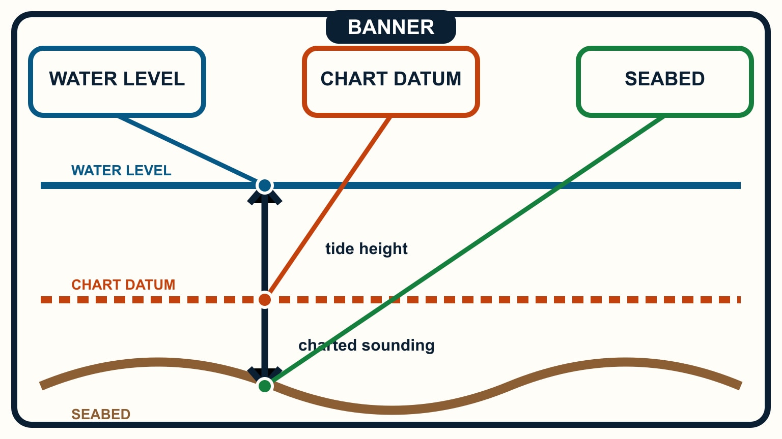
Chart datum is the vertical reference used for charted depths and tide heights in a local charting system. A sounding is the depth shown from that datum down to the seabed. A predicted tide height is the water level above or below the same datum at a stated place and time. When both values share compatible units and datum, estimated water depth is charted depth plus tide height. Subtract the boat's maximum draft and a margin for squat, waves, pressure, survey uncertainty, and local conditions to estimate under-keel clearance. Use the chart's notes and the official tide source; do not mix a sounding from one reference with a prediction from another.
The arithmetic is simple. The source checks are the real navigation work. You need to know which number is below datum, which is above it, and what the clock and units mean. Understanding tide tables explains how to find the prediction; this guide connects it to the chart.
Find units and datum before using a sounding
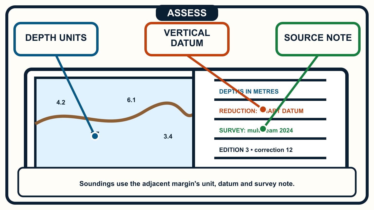
Read the chart title, edition, scale, depth unit, horizontal datum, vertical datum, and source notes. NOAA notes that chart soundings are water-depth measurements and that the chart states whether they are in feet, fathoms, or metres. Electronic charts can change display detail with zoom, so open the information panel rather than assuming every numeral uses your preferred unit.
The vertical datum is a defined reference surface, commonly chosen near a low-water level for navigation charts, but the exact definition varies by hydrographic authority and place. Use the name printed on the chart. The horizontal datum controls latitude and longitude; it is a different question from the vertical reference used for depth.
Identify the controlling sounding along the intended corridor, not merely the smallest number near a waypoint. Read depth contours, drying areas, rocks, dredged limits, and notes that may qualify the value. Survey age and sparse source data affect the confidence you place in a contour between individual soundings.
Keep the units beside the number in your working. “2.4” without “m” or “ft” invites a later mistake, especially when crew use both systems. If converting, show the conversion once and keep the remainder of the calculation in one unit.
Put the sounding below the datum line
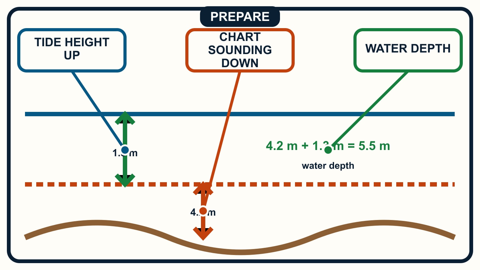
Draw a vertical cross-section. Put chart datum on a horizontal line. Place the sounding as a distance downward from datum to the seabed. Then place the predicted tide height upward from datum to the water surface. The full surface-to-bottom distance is the sum when the tide height is positive.
For example, if an updated chart shows 2.0 m at the controlling point and the official prediction gives 1.5 m above the same datum, the estimated water depth is 3.5 m. In imperial units, a 6 ft sounding plus 5 ft of tide gives 11 ft. These are worked examples, not operating margins.
A negative tide height sits below datum and reduces the charted depth. Add the signed value: 2.0 m plus negative 0.3 m gives 1.7 m. Do not silently turn the minus sign into extra water because chart datum is usually low. Meteorological conditions can also move observed water away from an astronomical prediction.
Use the prediction for the relevant location and time. Secondary ports or stations may require an official correction. Check whether times are UTC, local standard time, or local civil time and whether daylight-saving treatment is already included.
Subtract draft and a real margin
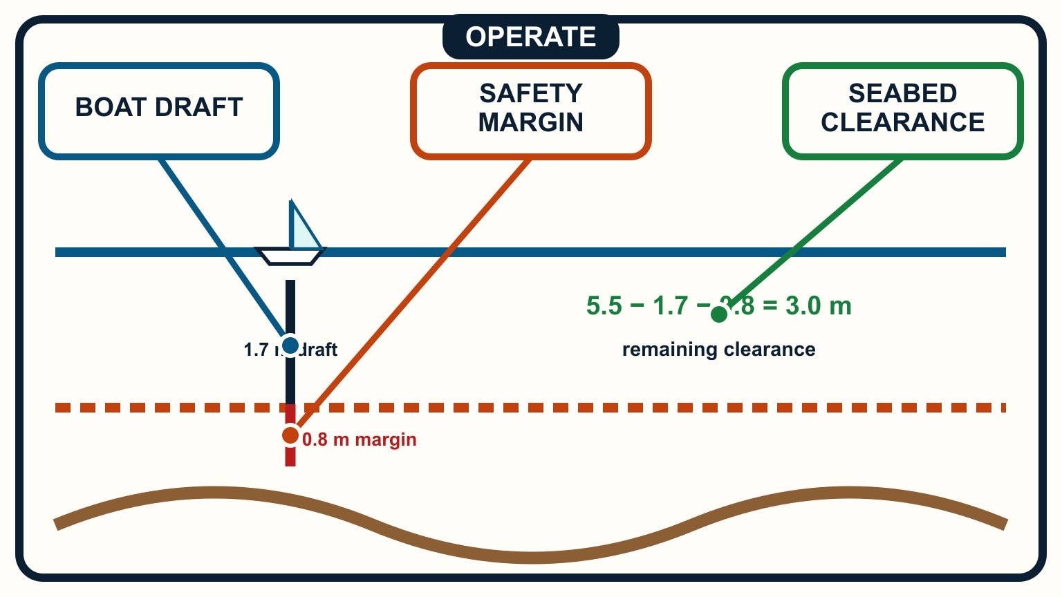
Draft is the vertical distance from the waterline to the boat's lowest point. Use the maximum operating draft for the current loading and configuration. A retractable keel, appendage, damaged transducer, or uncertain specification can change the number. Confirm it from the boat's documents and physical condition.
Under-keel clearance equals estimated water depth minus draft. If the example depth is 3.5 m and the boat draws 1.8 m, the arithmetic clearance is 1.7 m. That value still is not a promise. The plan needs a separate margin for the conditions and reliability of the information.
Consider waves and swell, boat motion, squat under power, density changes, chart and survey uncertainty, silting, tide-prediction error, and depth-sounder offset. The appropriate allowance depends on the vessel and route. A harbour's required minimum or a charter company's rule may set a larger limit; verify current local requirements.
If the planned margin vanishes under a modest change in tide or motion, choose a better time or route. Do not use a depth sounder alarm to justify a passage that already lacks clearance on the chart. Sailboat draft and under-keel clearance develops that risk decision.
Keep drying heights on the other side of datum
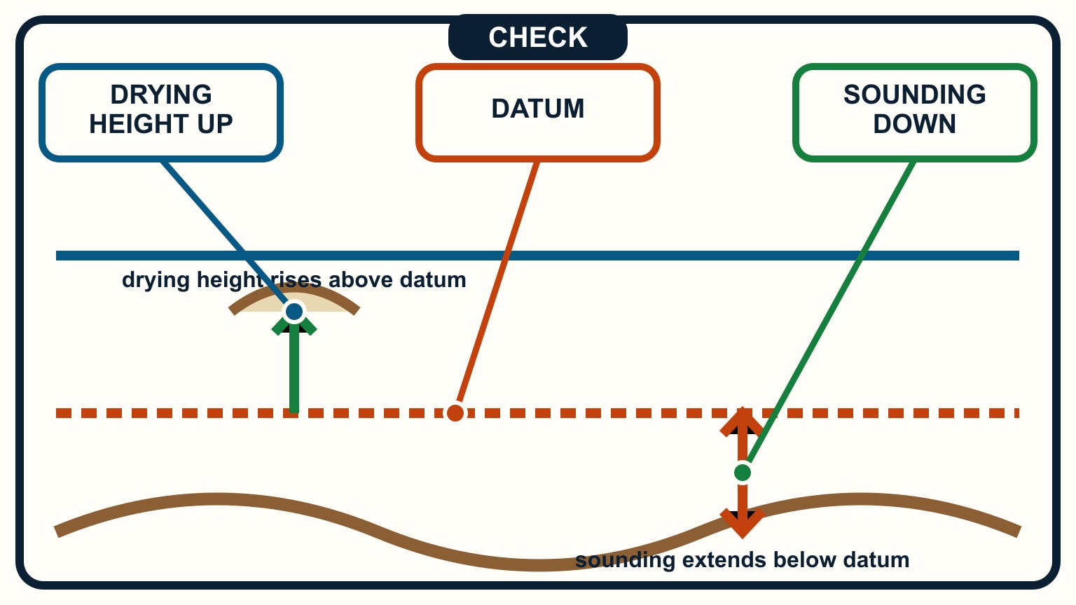
A drying height measures upward from chart datum to a feature that stands above datum. It is not a depth below datum. Chart 1 symbol guides distinguish drying figures from ordinary soundings, often by an underline or another notation defined in the legend. Read the symbol guide for the charting authority rather than relying on typography remembered from another chart.
To estimate water over a drying feature, compare the predicted tide height with the drying height. If the tide height is greater, the difference estimates water above the feature. If it is smaller, part of the feature is predicted to remain exposed. Apply the same source, unit, timing, and margin cautions used for soundings.
Never add a drying height to tide height as if it were a sounding. Their arrows point in opposite directions from datum. Redrawing the cross-section often catches the sign error immediately.
Rocks and obstructions may also carry special symbols and least-depth notes. A single arithmetic result does not clear the surrounding area. Check the full route, symbol meaning, horizontal position uncertainty, and whether the chart warns that the feature's depth is approximate.
Cross-check the prediction with the water
Write the complete calculation beside the route: source station, date, time basis, charted value, tide height, estimated water depth, draft, chosen margin, and minimum acceptable depth-sounder reading. This gives the helm a number that can be checked and an explanation if it is wrong.
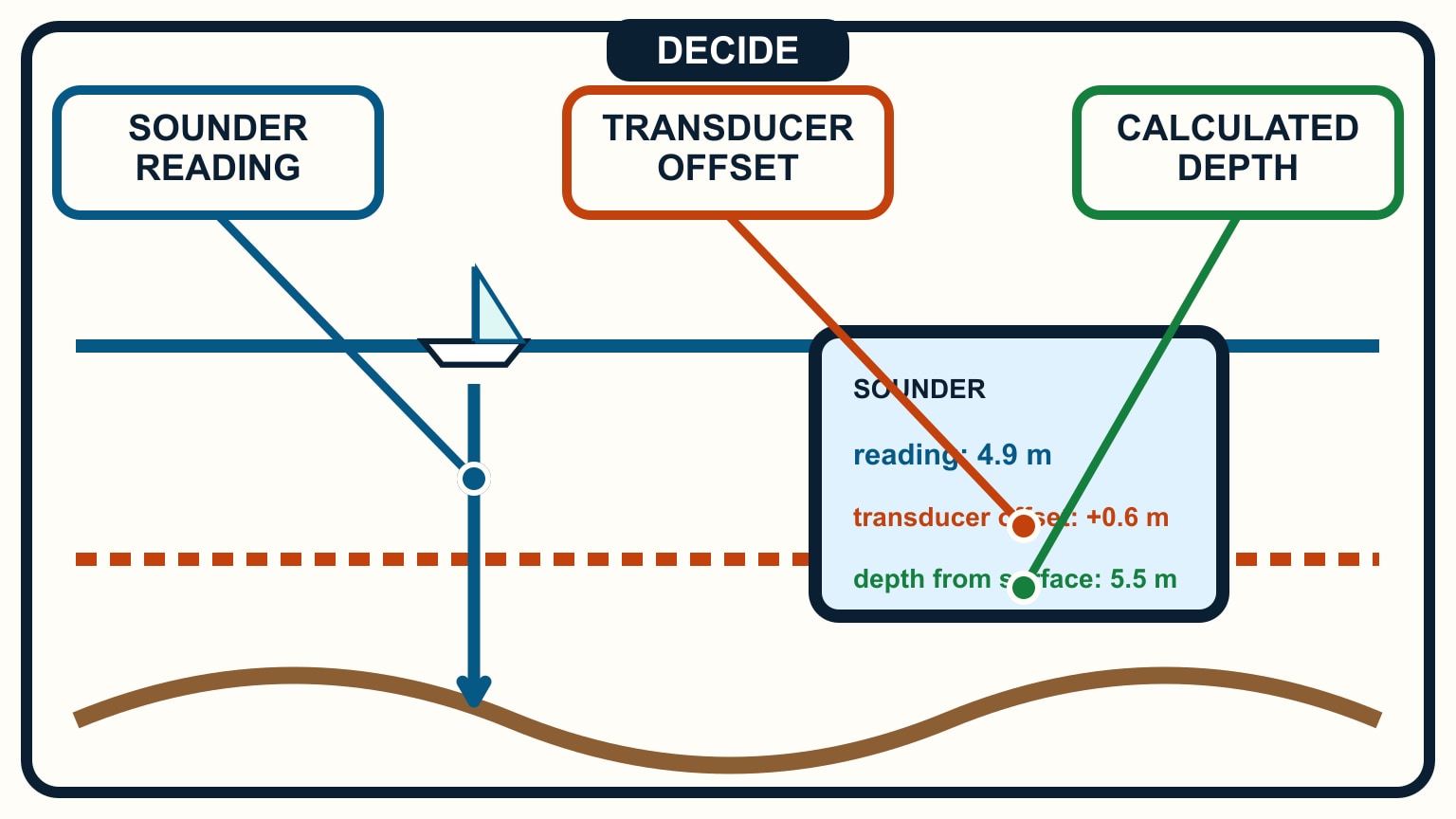
Understand the sounder's reference. Its transducer may report depth below the sensor, be configured to estimate depth below keel, or include another offset. Compare it with known water while safely afloat. A displayed “3.0” cannot be compared with a chart calculation until its reference and unit are known.
Monitor trends as well as values. Depth decreasing sooner than planned, observed water below prediction, or a changed seabed contour calls for slow speed and a move toward known safe water. Never drive on to make the display match the plan.
Update the source near departure. Tide predictions, chart corrections, dredging, silting, and local notices can change the practical route. NOAA and other hydrographic offices publish current official services; use the authority responsible for the waters you are entering and verify current local information. The same charted-depth-plus-tide arithmetic is what you check before settling on an anchorage for the night.
SailStarter's navigation lessons help you build the mental cross-section behind these numbers. Keep the datum line in the middle: soundings go down, positive tide heights go up, and drying heights rise from the other side. Then subtract the boat and a margin. If datum, units, time, or sounder offset remain unclear, the answer is not to calculate harder. Stop and resolve the reference before using the result to enter shallow water.
Work one sample before the voyage and have another crew member reproduce it. Write every quantity with its source, time, datum, and unit: charted sounding, predicted height, draft, squat or heel allowance where relevant, wave allowance, and the final safety margin. If a value cannot be tied to the same datum and location, do not put it into the arithmetic simply because it is available.
Keep the calculation beside the route's controlling point and compare it with observed depth well before the shallowest water. Echo sounder offset must be known: a display may be configured below the transducer, below the keel, or as total water depth. Treat an unexplained discrepancy as a reason to stop or divert in safe water, not as permission to tune the assumptions until the numbers agree. Update the calculation when arrival time changes because the predicted tide height changes with it.
Repeat the arithmetic aloud before committing to shallow water. A unit or sign error caught by the helm is a successful cross-check, not an embarrassment. This method estimates clearance; it does not certify it. Survey age, seabed movement, atmospheric effects, waves, boat motion, loading, and instrument error all deserve margin appropriate to the place and vessel.
Try it from the lesson
Can you spot the next move?
It's been blowing a strong onshore wind all day, and the barometer has dropped a lot. Should you trust the tide table's predicted height exactly?
Why you can trust this guide
. We build each guide from public seamanship and safety sources, then teach the universal principle before any local difference.