Chart your course
How to Read a Marine Forecast
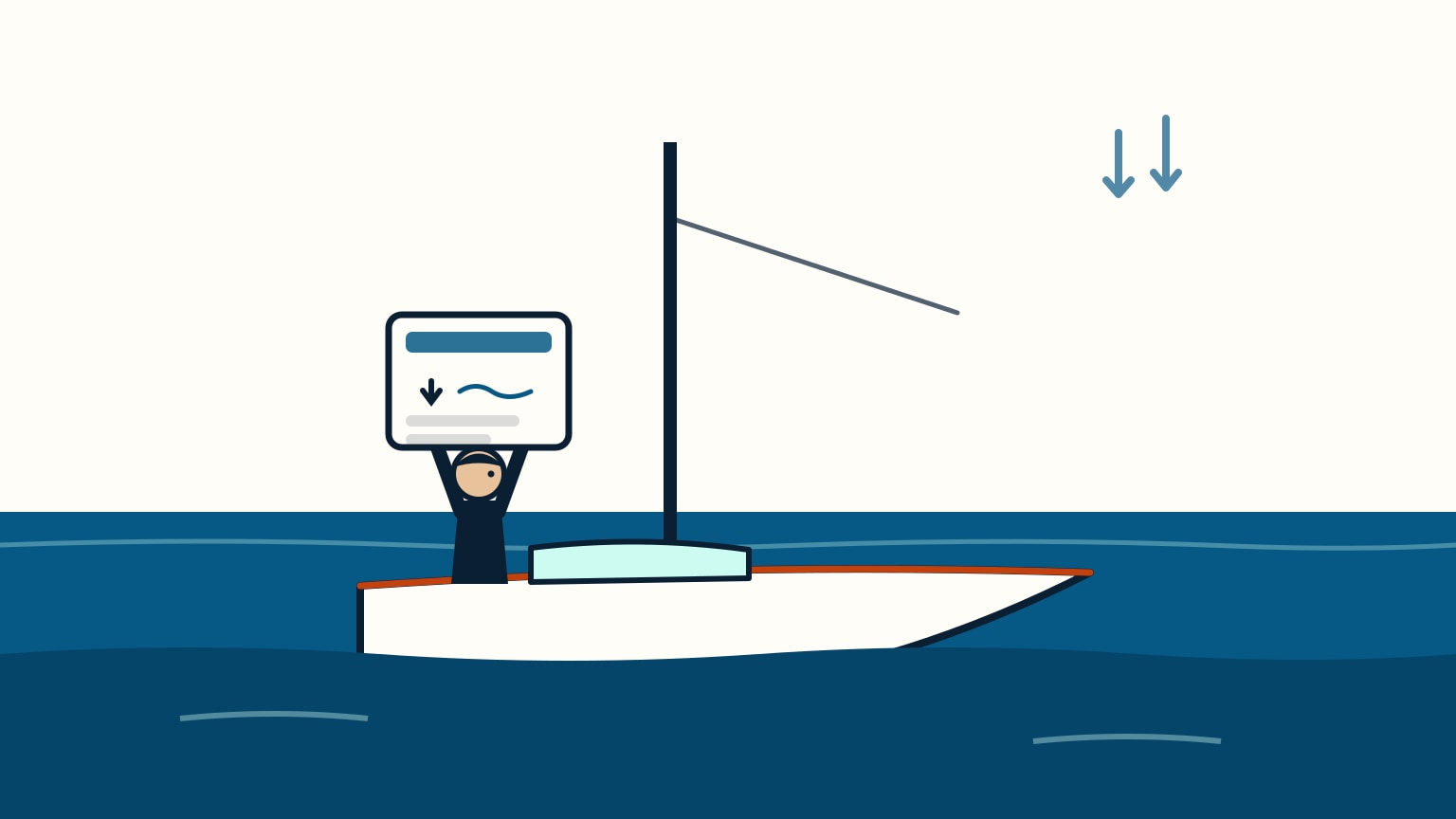
Quick answer
The short version
A marine forecast is written for a specific zone of coastal water, not your whole coastline, so start by finding the zone that actually covers where you're sailing. From there, every service states the same handful of fields: wind speed and direction, sea state, visibility, any warnings, and when the forecast was issued and how long it's valid. The wind figure is a sustained average, not a ceiling; real gusts can run higher. Always pull the freshest official issue close to departure. Forecasts are reissued on a schedule, and a phone app's cached view can lag behind it. Warning ladders escalate everywhere, but the names and thresholds belong to each country, so check your own service's current terms.
A marine forecast can look like a wall of numbers the first time you open one. It isn't random: every service states the same short list of things, in roughly the same order, whether it's a text bulletin, a graphical app screen, or a voice broadcast. Once you know what you're looking for, reading one takes less than a minute.
This guide walks through that read-order: find your zone, scan the core fields, understand what the wind number actually promises, keep the forecast current, and recognize that a warning system exists even when you don't know its exact wording yet.
Find Your Forecast Zone First
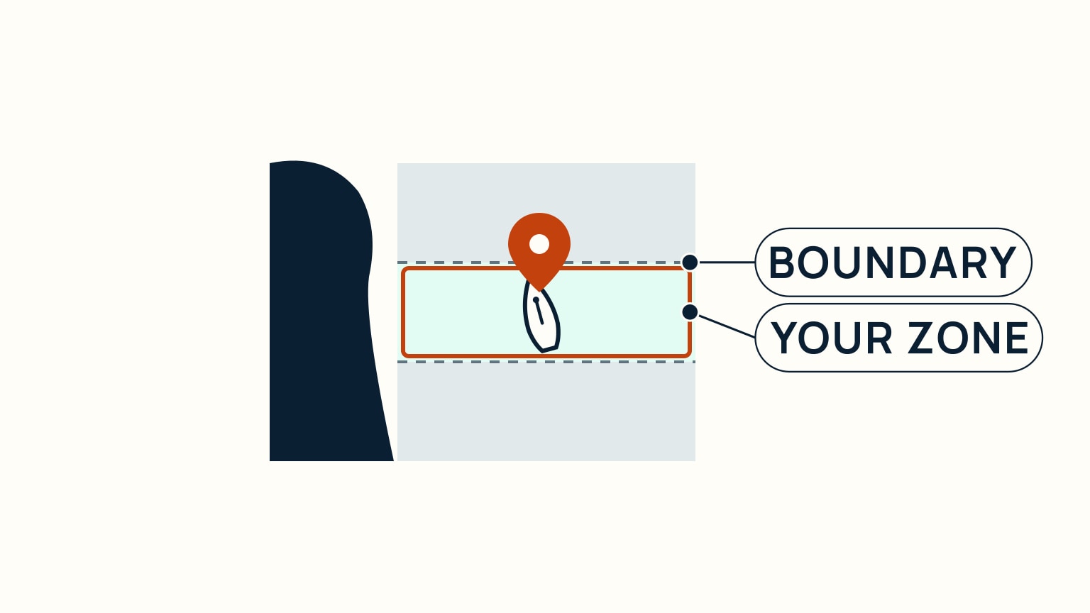
Marine forecasts are issued for named zones (defined stretches of coastal water), not for a whole coastline or a nearby city. A national weather service divides its waters into zones because conditions on the water can differ meaningfully from one stretch to the next; a single number for an entire coast would blur those differences away.
Find the zone that actually covers where you're sailing, not just the nearest one on a map. Most official marine-forecast sites let you search or click through a zone map to land on the right bulletin. Do this once, before you need it under time pressure, and you'll go straight to the right forecast every time after.
Read the Core Fields on Any Forecast
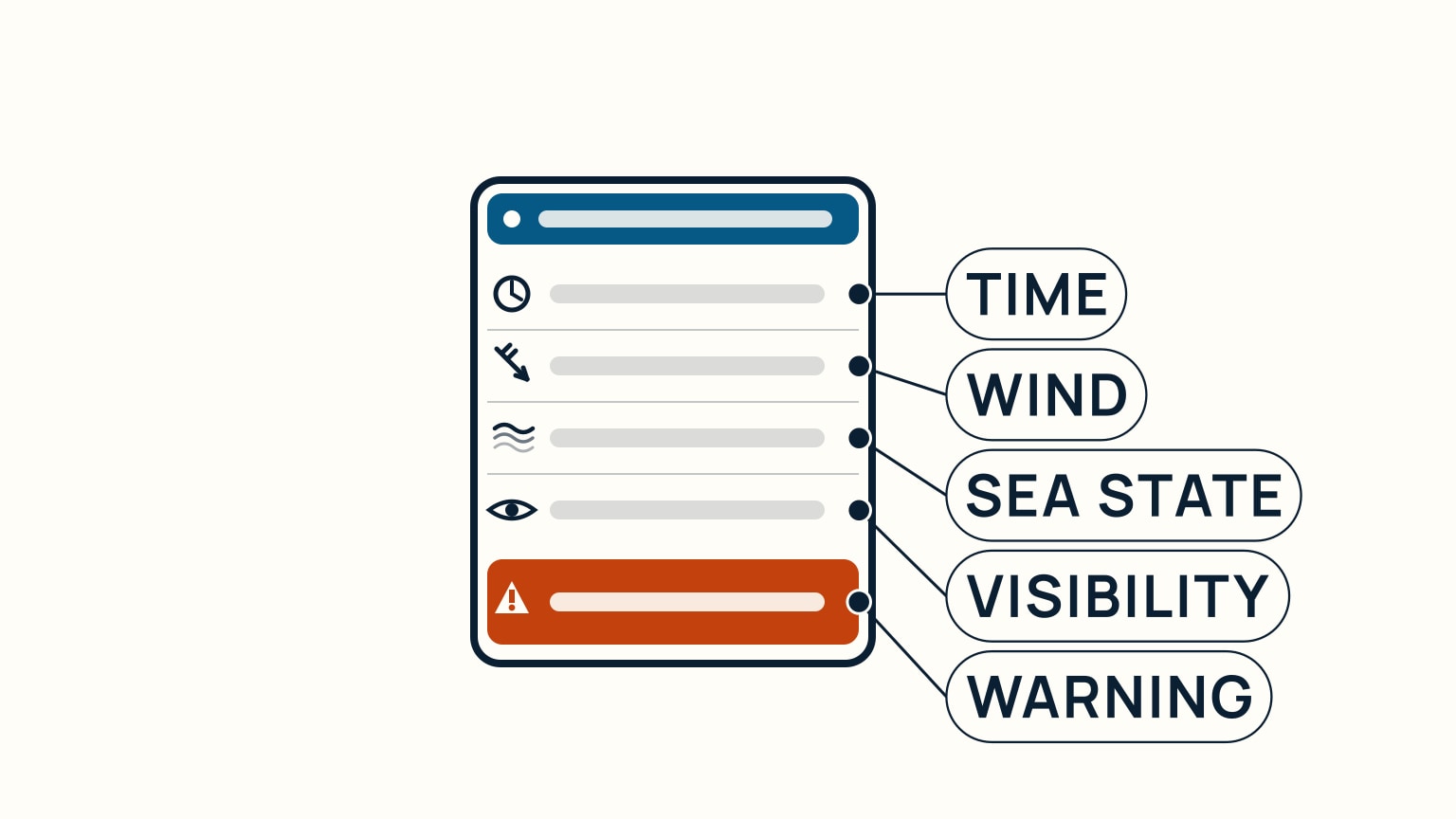
However it's formatted, a marine forecast states the same core fields: wind speed and direction, sea state (the wave conditions from wind and swell combined), visibility, any active warning, and the times the forecast was issued and how long it stays valid. Learn to scan for these five things and you can read any service's forecast, anywhere.
Wind and sea state describe the conditions you'll actually feel and see on the water. Visibility matters most in fog, haze, or poor light. The warning field, when present, is the forecast's clearest signal that conditions may be hazardous. The issue and valid times tell you whether you're looking at the current bulletin or one that's already been superseded.
Treat the Wind Number as an Average, Not a Ceiling
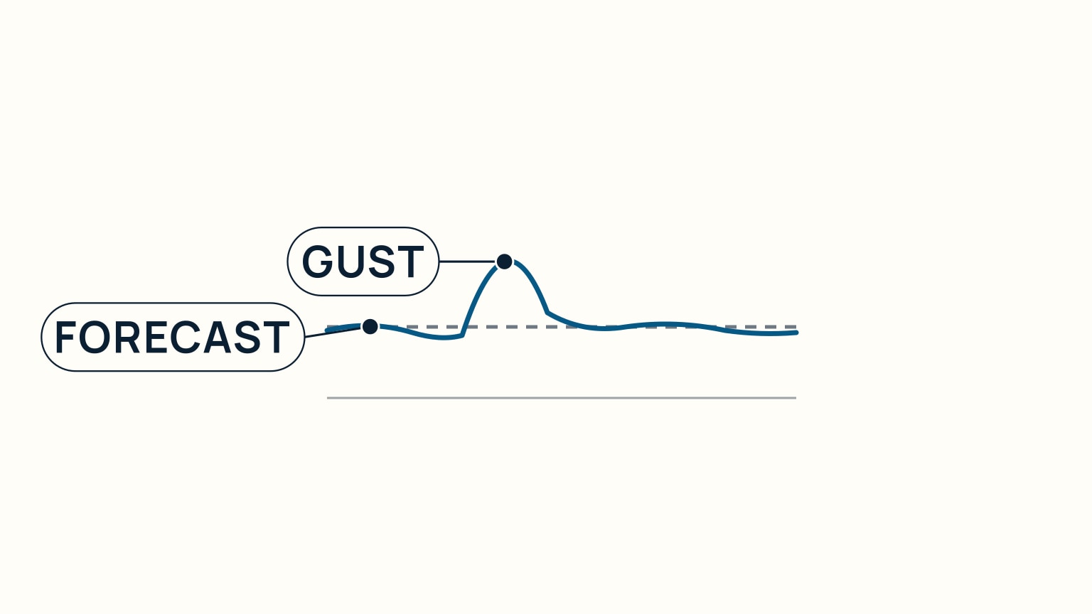
A forecast's stated wind speed is a sustained figure (an average), not a peak. A real gust can run well above the number on the page. Reading "12 knots" as "it will never blow harder than 12 knots" is the single most common way beginners misread a forecast.
Plan around the gust as well as the average. Reef early, keep an eye on darkening skies or a building sea, and do not treat a moderate forecast number as a guarantee of moderate conditions for the whole trip. A forecast wind value can describe an average while stronger gusts still occur. The forecast also reports true wind; once the boat is moving, the apparent wind at the helm will differ from that number.
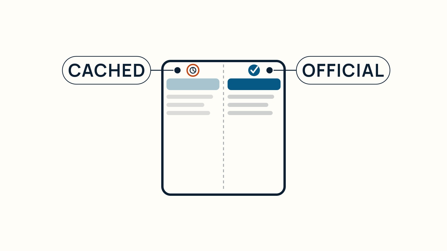
Always Get the Freshest Official Issue
A forecast is only good until it's superseded. Official services reissue forecasts on a regular schedule, and again immediately whenever conditions warrant it, regardless of that schedule. An older issue isn't wrong. It was accurate when it was published; it's just no longer the current one.
A phone app or chartplotter overlay is a convenient way to see a forecast, but it's typically showing a copy, refreshed on its own schedule. When it disagrees with the official service's current bulletin, or looks like it hasn't refreshed in a while, trust the official service. Check the freshest official issue again close to departure, not the one you glanced at over breakfast.
Know That a Warning Ladder Exists
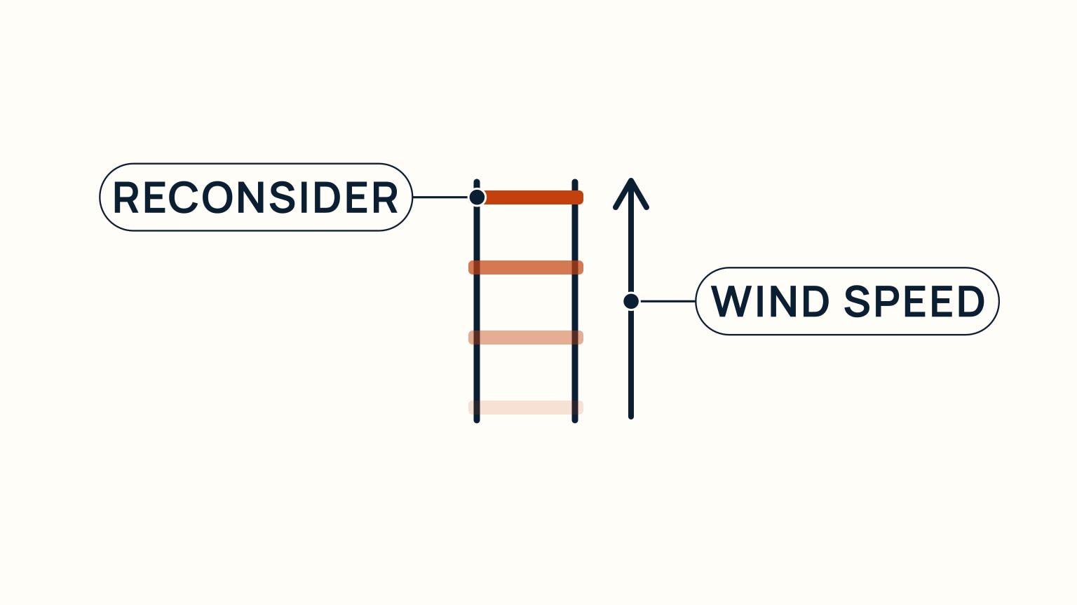
Every national marine forecasting service escalates through a warning ladder as wind builds (a series of named, increasingly serious categories, each meaning "reconsider this trip" more strongly than the last). The ladder concept is universal. The exact names and the wind speeds attached to them are not: each country's meteorological service sets its own.
In the US, the National Weather Service issues a Small Craft Advisory, then a Gale Warning (sustained winds or frequent gusts of 34 to 47 knots), then a Storm Warning (48 to 63 knots). In Canada, Environment Canada issues a Strong Wind Warning (20 to 33 knots), then Gale-force, Storm-force, and Hurricane-force Wind Warnings at closely matching bands higher up. Do not assume a warning name you learned in one place carries over somewhere else. Check what your own service currently calls it. You can also receive the current forecast without a screen over a VHF weather broadcast. SailStarter's lessons cover using a VHF radio later in the course.
Turn the forecast into a route decision
Mark the forecast zone for every leg, then build a simple timeline from departure to return. Add wind direction and speed, gusts, sea state, visibility, precipitation, and any warnings at the time each leg is expected. A forecast that looks manageable at departure may describe a different return.
Compare that timeline with the crew, boat, daylight, shelter, and alternative stops. Decide which change would shorten the route or keep the boat in protected water. The weather and float-plan guide shows how to leave the resulting route and return time with someone ashore.
Read uncertainty without ignoring it
Forecasts describe expected conditions over an area and period. They do not promise one wind at your exact position. Gust wording, changes in direction, sea-state ranges, and warning language all add context to the main number. Nearby headlands, channels, and open fetch can make the local experience differ from a broad zone.
Use the latest official issue and note its time. Compare it with recent observations before departure and continue monitoring updates under way. If the observed trend no longer fits your plan, revise the plan. Waiting for every detail to match the forecast can waste the time available for a conservative choice.
Use personal limits in plain language
Write conditions that trigger a shorter trip, shelter, or cancellation. Include visibility, sea state, wind direction at the berth, crew fatigue, and the ability to reef or return. Avoid copying a universal threshold from another boat. The same forecast can create different workloads for a dinghy, a cruising keelboat, and an inexperienced crew.
Review strong-wind preparation before a forecast near the top of your current experience. The useful question is not whether the boat could survive the number. It is whether this crew can complete the whole route, including the return and docking, with suitable margin.
Check again at fixed moments
Choose check points before leaving: final dock check, a turn toward open water, and a decision point before the return becomes difficult. At each one, compare the latest issue, visible conditions, remaining daylight, and crew state with the plan. State the decision aloud.
This routine prevents the forecast from becoming a one-time permission slip. It remains an input throughout the sail. If a warning is issued or conditions build sooner than expected, act on the change while simple alternatives remain.
Reading a marine forecast comes down to the same handful of habits every time: find your zone, scan wind, sea state, visibility, and warnings, remember the wind number is an average, and always work from the freshest official issue. None of it requires memorizing one service's exact wording. It requires knowing what to look for and where to check when you need the current answer. SailStarter's beginner lessons walk through reading a real forecast card step by step, alongside the rest of the seamanship basics you'll want before you leave the dock.
Keep a short forecast note in the log: source, issue time, zone, expected change, and the decision it produced. After the sail, add the observed trend. This does not grade the forecast by one point on the water. It trains you to read timing, area, and uncertainty, then notice which parts mattered to the crew's route.
If you repeatedly misunderstand a term, use the issuing service's glossary rather than a casual definition. The wording belongs to that forecast system and may carry a specific operational meaning.
Try it from the lesson
Can you spot the next move?
Your weather app, opened this morning, shows calm conditions. It's now mid-afternoon and you're about to leave. What should you check first?
Why you can trust this guide
. We build each guide from public seamanship and safety sources, then teach the universal principle before any local difference.